General Information
Internal Identifier leuther
| Soil Type | Haplic Chernozem |
|---|
| Classification | FAO |
|---|
|
| Location | Bad Lauchstädt |
|---|
| Latitude | 51.39178 |
|---|
| Longitude | 11.87701 |
|---|
|
| Landuse | Grassland |
|---|
| Tillage | No tillage |
|---|
| Crop | gras |
|---|
|
| Sampling Depth | 5.0 |
|---|
| Sample Height | 3.0 |
|---|
| Sampling Date | June 1, 2021 |
|---|
| Voxel size | 0.015 |
|---|
| Pores white? | True |
|---|
|
| XY Plane |
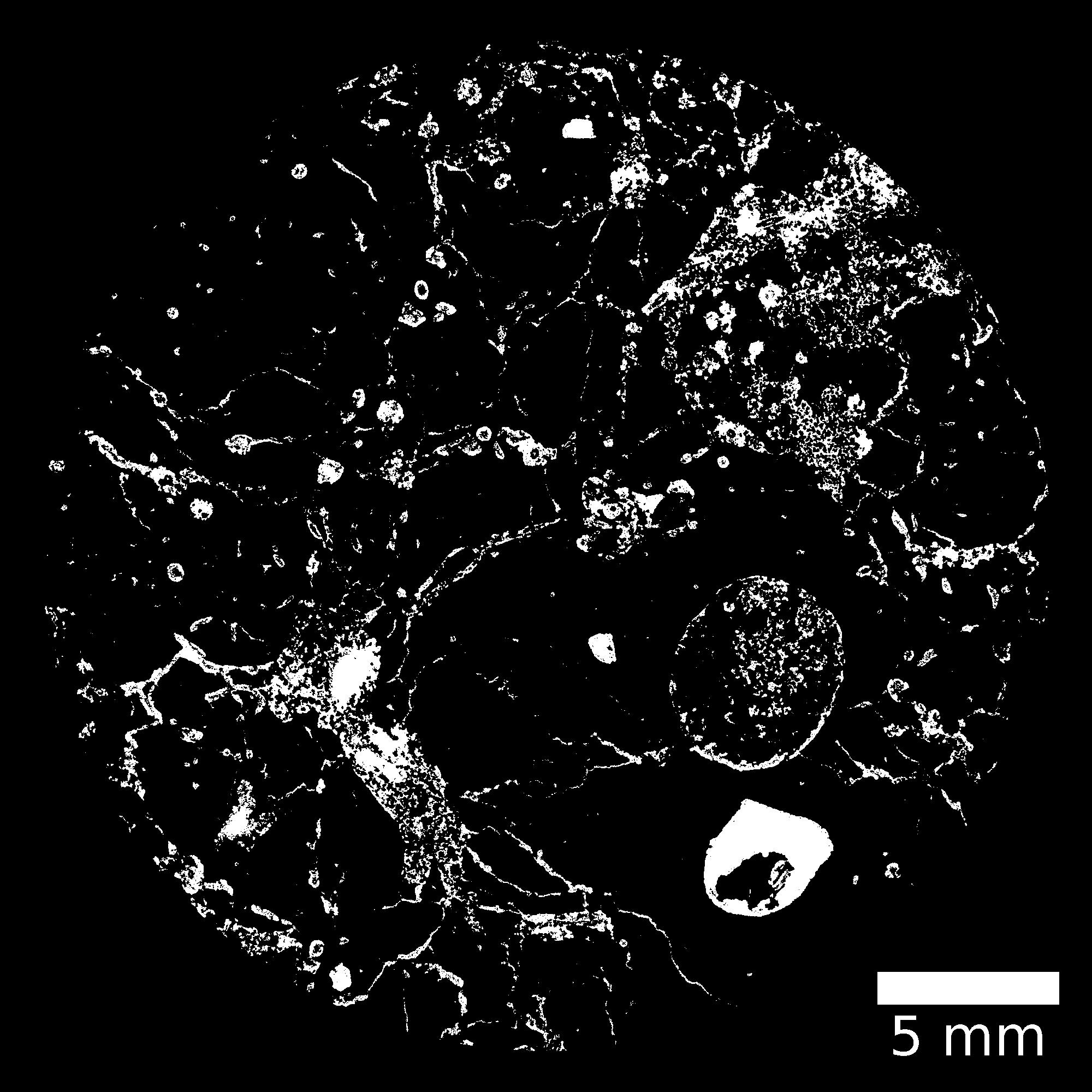
|
|---|
|
| XY Plane Grey |
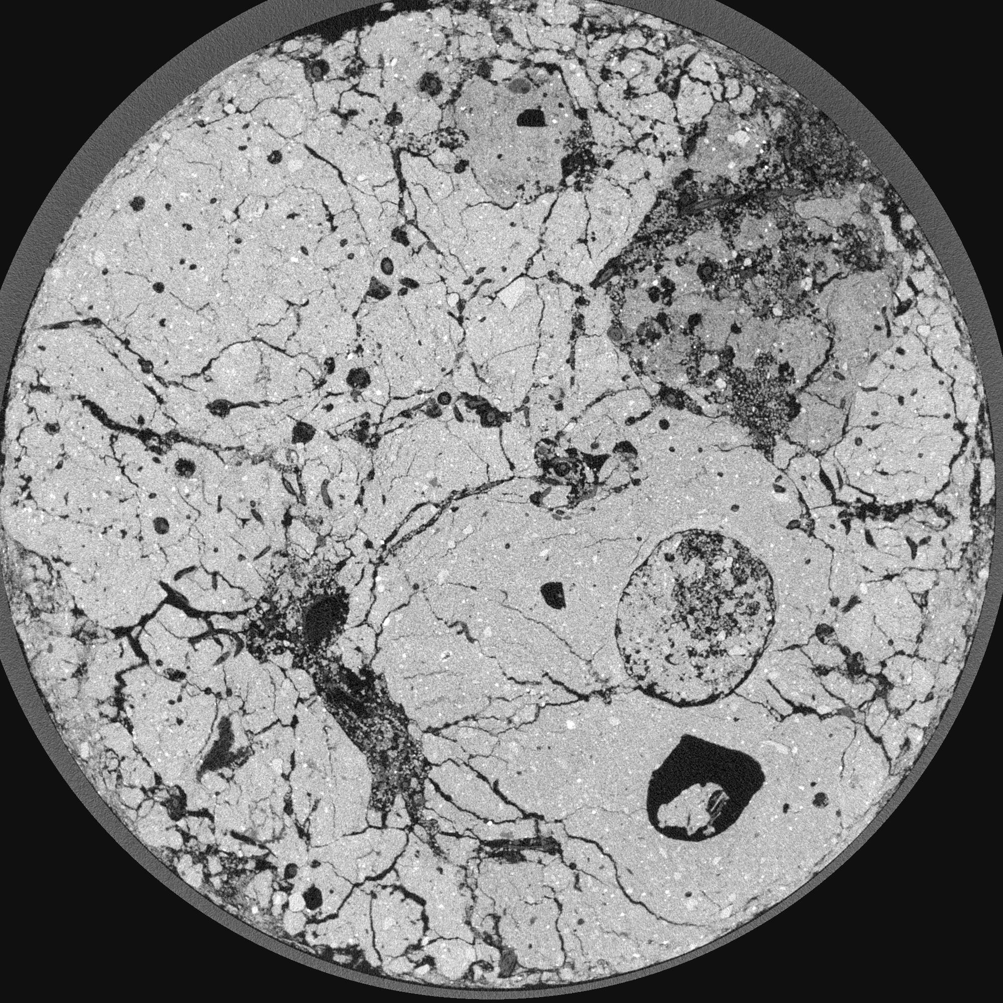
|
|---|
|
| Texture | silty loam |
|---|
| Sand | 11.0 |
|---|
| Silt | 68.0 |
|---|
| Clay | 21.0 |
|---|
|
|
Results
| Porosity | Surface | Mean Curvature | Euler | MeanPoreSize | Gamma | PoreDist |
| 0.208535967 | 9.77785416 | 13.670129733 | -26.131995293 | 0.0847109038835 | 0.788353870447 | 0.157750182 |
| Opening size | Volume | Surface | MeanCurvature | Euler number |
|---|
| 0.03 | 0.208535967 | 9.77785416 | 13.670129733 | -26.131995293 |
| 0.0375 | 0.195819338 | 7.783966684 | 9.540358364 | -31.319618961 |
| 0.045 | 0.178523791 | 6.722549121 | 7.971952712 | -20.714054296 |
| 0.0525 | 0.164881204 | 5.979860692 | 7.048910328 | -4.751754313 |
| 0.06 | 0.158139148 | 5.619232309 | 7.012572878 | 11.162430222 |
| 0.0675 | 0.118927546 | 3.947217739 | 4.892753304 | 8.289301135 |
| 0.075 | 0.10028057 | 3.249289123 | 4.133676136 | 9.262223803 |
| 0.09 | 0.08327159 | 2.586291257 | 3.375617958 | 9.175899028 |
| 0.105 | 0.048330525 | 1.378497344 | 1.780591128 | 5.918907725 |
| 0.12 | 0.032575143 | 0.884786159 | 1.136194809 | 3.921762829 |
| 0.135 | 0.016572279 | 0.404449091 | 0.479333526 | 1.702791565 |
| 0.15 | 0.011409955 | 0.262029791 | 0.297490216 | 0.969030978 |
| 0.165 | 0.005221876 | 0.104372429 | 0.107915121 | 0.360158282 |
| 0.18 | 0.003523089 | 0.062029421 | 0.058155504 | 0.165927539 |
| 0.195 | 0.002211269 | 0.032240199 | 0.025751392 | 0.072880753 |
| 0.21 | 0.001856871 | 0.024291571 | 0.017177793 | 0.043516178 |
| 0.225 | 0.001487039 | 0.01671109 | 0.009147694 | 0.016628133 |
| 0.3 | 0.001019464 | 0.010217206 | 0.004947802 | 0.006722011 |
| 0.375 | 0.000622795 | 0.005528612 | 0.002307839 | 0.00283032 |
| 0.45 | 0.000391724 | 0.003702734 | 0.001721354 | 0.00212274 |
| 0.525 | 0.000092258 | 0.000908471 | 0.000459059 | 0.00070758 |
Reference: An open Soil Structure Library based on X-ray CT data
 Soil Structure Library