General Information
Internal Identifier CG_G2_O_a
| Soil Type | Chernozem |
|---|
| Classification | WRB |
|---|
|
| Location | Bernburg (Westerfeld) |
|---|
| Latitude | 51.820 |
|---|
| Longitude | 11.700 |
|---|
|
| Landuse | agricultural crop rotation |
|---|
| Tillage | reduced tillage |
|---|
| Crop | winter wheat, maize, winter wheat, winter rape, winter barley |
|---|
|
| Sampling Depth | 13.0 |
|---|
| Sample Height | 10.0 |
|---|
| Sampling Date | March 28, 2017 |
|---|
| Voxel size | 0.06 |
|---|
| Pores white? | True |
|---|
|
| XY Plane |
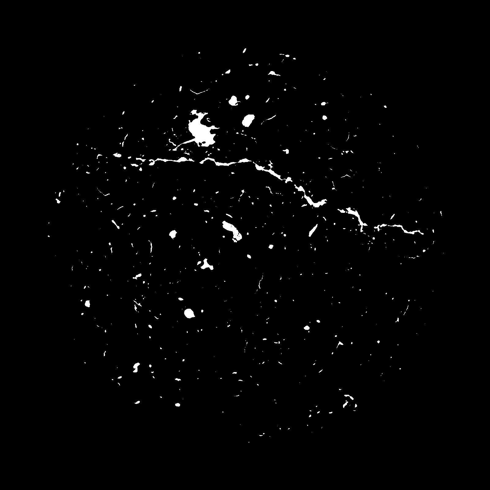
|
|---|
|
| XY Plane Grey |
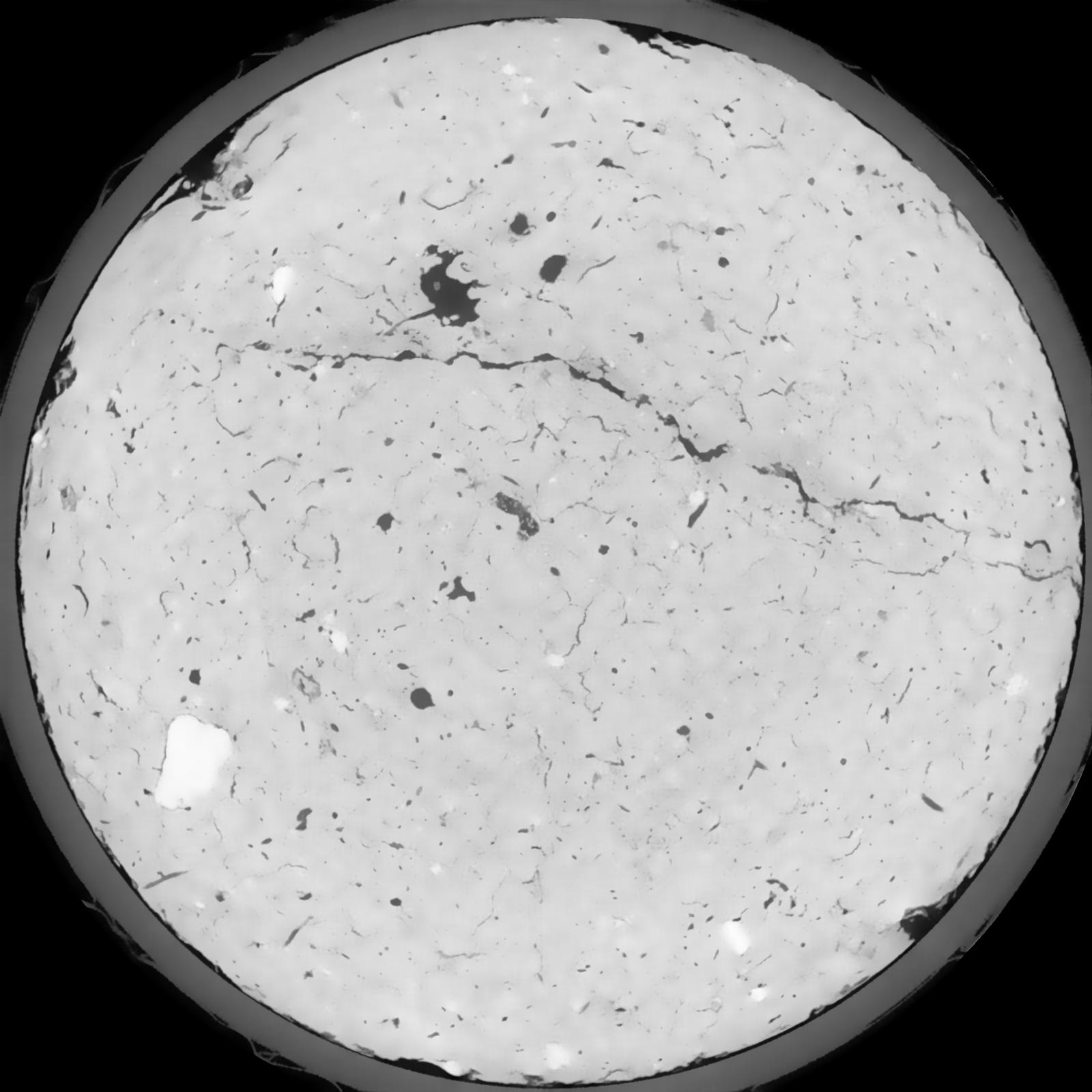
|
|---|
|
| Texture | silt loam |
|---|
| Sand | 8.0 |
|---|
| Silt | 79.0 |
|---|
| Clay | 13.0 |
|---|
|
|
Results
| Porosity | Surface | Mean Curvature | Euler | MeanPoreSize | Gamma | PoreDist |
| 0.02708 | 0.245666667 | 0.168083333 | 0.473148148 | 0.0 | 0.4164 | 0.587167579 |
| Opening size | Volume | Surface | MeanCurvature | Euler number |
|---|
| 0.12 | 0.02708 | 0.245666667 | 0.168083333 | 0.473148148 |
| 0.15 | 0.02527 | 0.193833333 | 0.098583333 | 0.154259259 |
| 0.18 | 0.02393 | 0.16475 | 0.069638889 | 0.078240741 |
| 0.21 | 0.02295 | 0.147366667 | 0.05625 | 0.05787037 |
| 0.24 | 0.02254 | 0.1413 | 0.054194444 | 0.067175926 |
| 0.27 | 0.02006 | 0.106833333 | 0.032277778 | 0.027856481 |
| 0.3 | 0.01904 | 0.095216667 | 0.026911111 | 0.023187037 |
| 0.36 | 0.01768 | 0.08045 | 0.020869444 | 0.01696713 |
| 0.42 | 0.01541 | 0.060066667 | 0.013105556 | 0.008839815 |
| 0.48 | 0.01412 | 0.050116667 | 0.010027778 | 0.006309259 |
| 0.54 | 0.01238 | 0.038333333 | 0.006622222 | 0.00440213 |
| 0.6000000000000001 | 0.01159 | 0.033416667 | 0.005355556 | 0.00303875 |
| 0.6599999999999999 | 0.01032 | 0.026583333 | 0.003752778 | 0.002281296 |
| 0.72 | 0.009703 | 0.023366667 | 0.003063889 | 0.001497083 |
| 0.78 | 0.008938 | 0.0199 | 0.0023825 | 0.001203009 |
| 0.8400000000000001 | 0.008585 | 0.0183 | 0.002088444 | 0.000846574 |
| 0.8999999999999999 | 0.007962 | 0.01581 | 0.001647861 | 0.000677269 |
| 1.2 | 0.006301 | 0.010101667 | 0.000780083 | 0.000249514 |
| 1.5 | 0.00523 | 0.00743 | 0.000505806 | 0.000187134 |
| 1.8 | 0.004144 | 0.005068333 | 0.000296222 | 0.000089111 |
| 2.1 | 0.003346 | 0.003495 | 0.000153986 | 0.000044556 |
| 2.7 | 0.002655 | 0.002585 | 0.000101589 | 0.000008891 |
| 3.3000000000000003 | 0.001953 | 0.001896667 | 0.000085014 | 0.000017823 |
| 3.9 | 0.00136 | 0.001354667 | 0.000065764 | 0.000008891 |
| 4.5 | 0.0006774 | 0.000714333 | 0.000037428 | 0.00000508 |
| 5.1 | 0.0002469 | 0.0002605 | 0.000014436 | 0.000002541 |
Reference: An open Soil Structure Library based on X-ray CT data
 Soil Structure Library