General Information
Internal Identifier AM_BE_AC_D10_4a
| Soil Type | Löß-Schwarzerde |
|---|
| Classification | German KA5 |
|---|
|
| Location | Bernburg |
|---|
| Latitude | 51.834278 |
|---|
| Longitude | 11.695056 |
|---|
|
| Landuse | Cropland |
|---|
| Tillage | conventional tillage |
|---|
| Crop | Wheat |
|---|
|
| Sampling Depth | 10.0 |
|---|
| Sample Height | 5.0 |
|---|
| Sampling Date | July 14, 2023 |
|---|
| Voxel size | 0.03 |
|---|
| Pores white? | True |
|---|
|
| XY Plane |
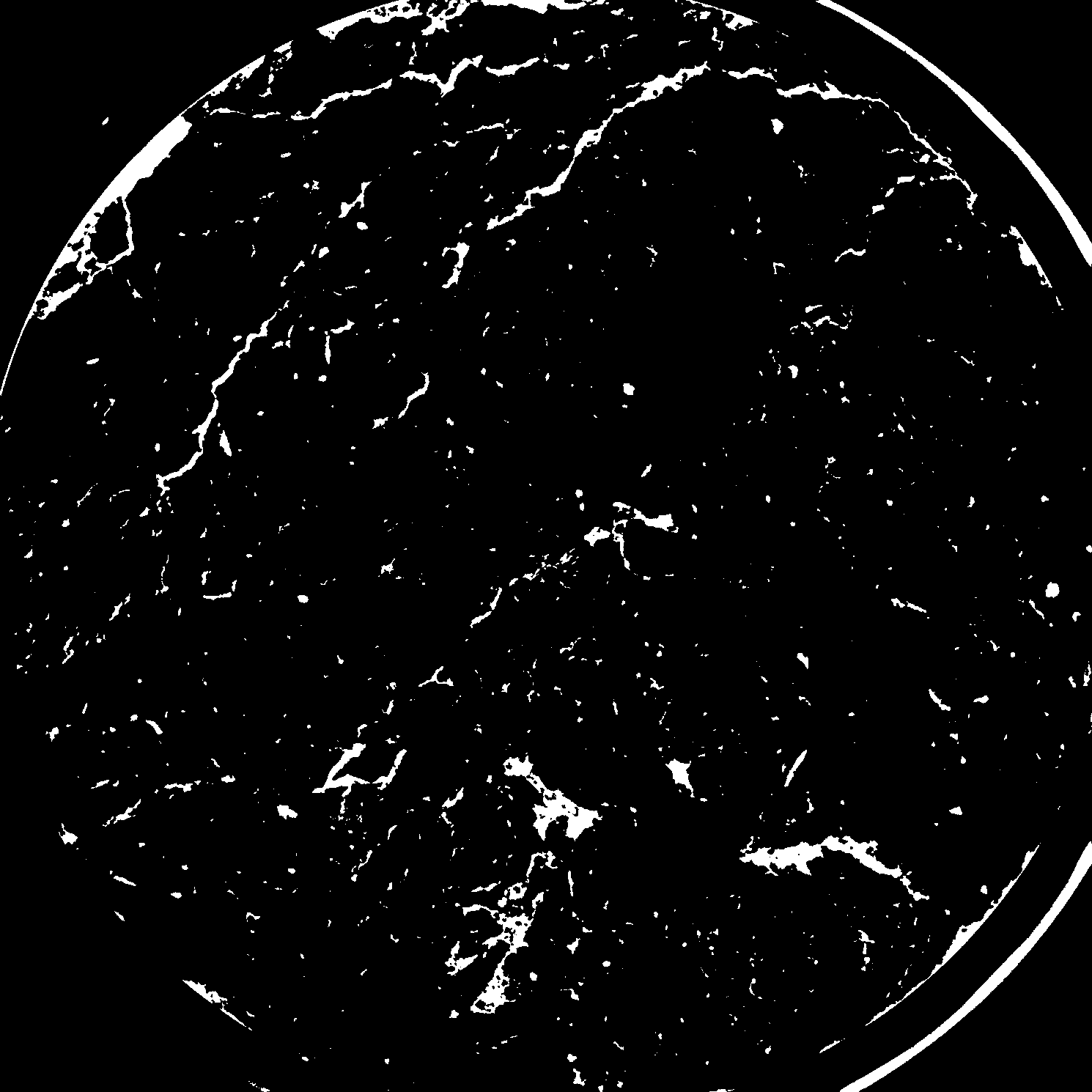
|
|---|
|
| XY Plane Grey |
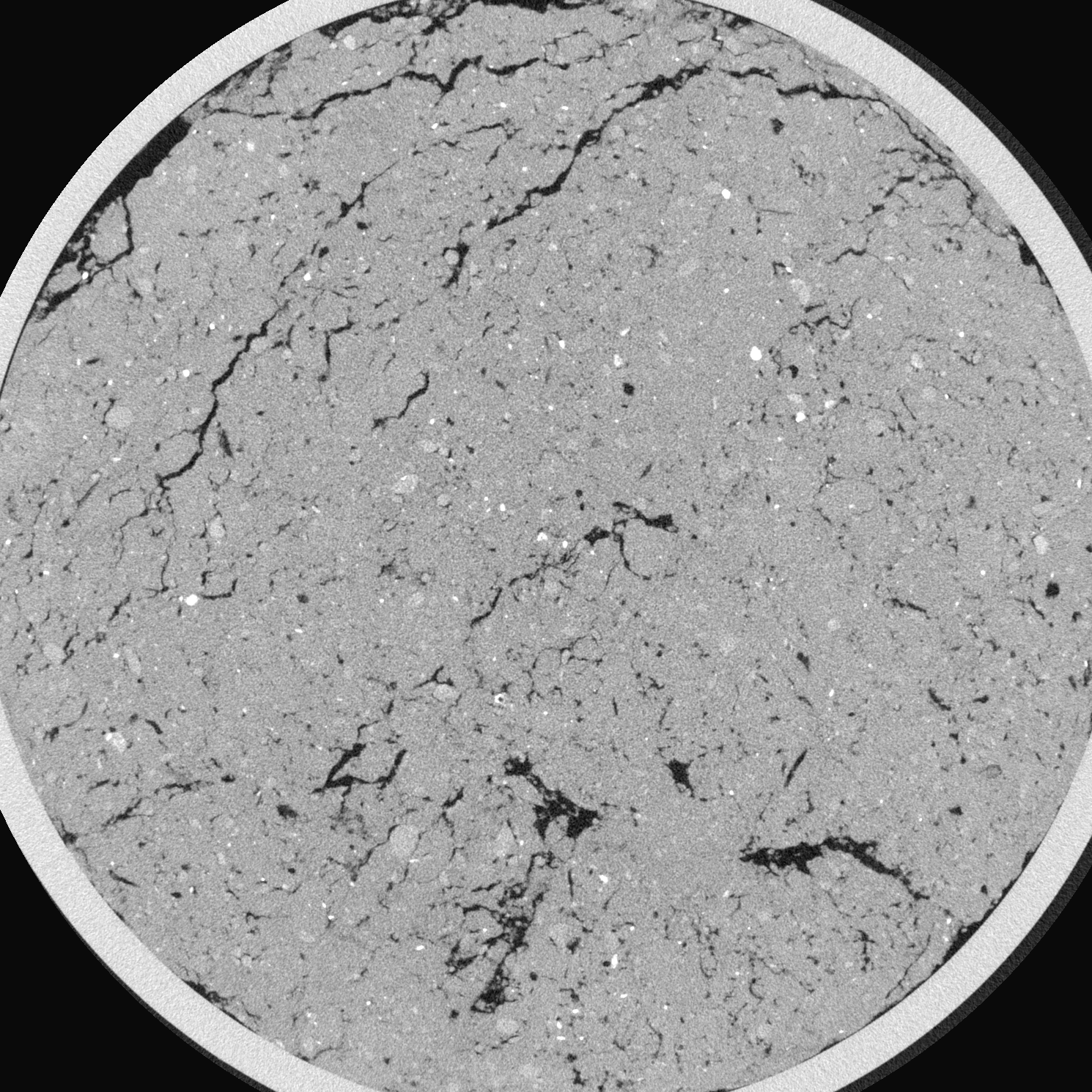
|
|---|
|
| Texture | Silt loam |
|---|
| Sand | 15.4316 |
|---|
| Silt | 62.87 |
|---|
| Clay | 21.6984 |
|---|
|
|
Reference: An open Soil Structure Library based on X-ray CT data
 Soil Structure Library