General Information
Internal Identifier AM_BYR_AC_D10_4a
| Soil Type | Luvisol |
|---|
| Classification | WRB |
|---|
|
| Location | Bayreuth |
|---|
| Latitude | 49.931889 |
|---|
| Longitude | 11.547722 |
|---|
|
| Landuse | Cropland |
|---|
| Tillage | Reduced |
|---|
| Crop | Wheat |
|---|
|
| Sampling Depth | 10.0 |
|---|
| Sample Height | 5.0 |
|---|
| Sampling Date | March 14, 2024 |
|---|
| Voxel size | 0.03 |
|---|
| Pores white? | True |
|---|
|
| XY Plane |
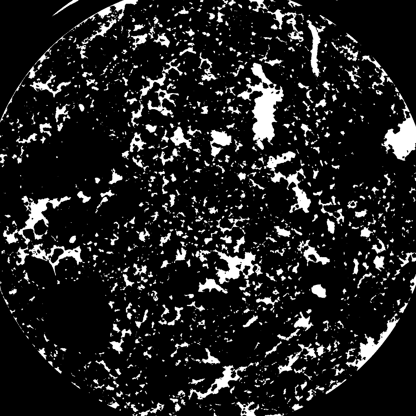
|
|---|
|
| XY Plane Grey |
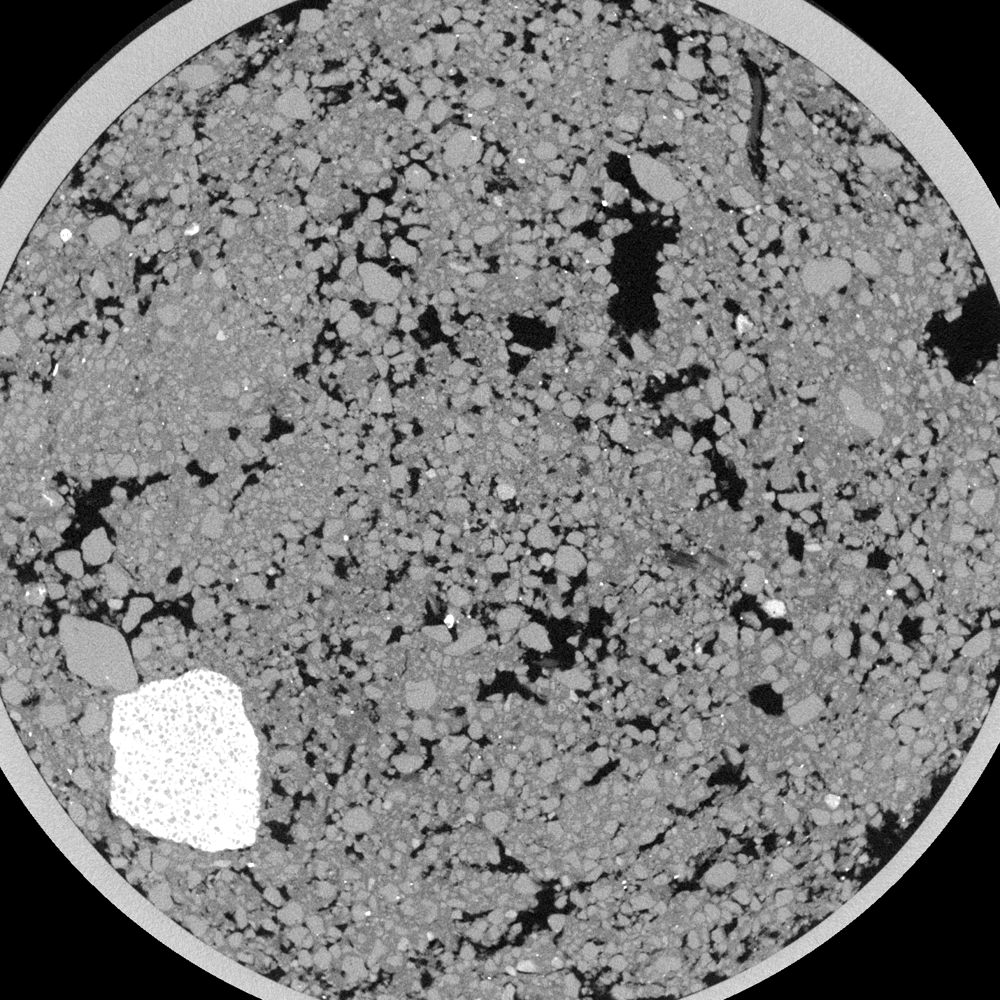
|
|---|
|
| Texture | Sandy clayey loam |
|---|
| Sand | 67.3537 |
|---|
| Silt | 18.9041 |
|---|
| Clay | 13.7422 |
|---|
|
|
Reference: An open Soil Structure Library based on X-ray CT data
 Soil Structure Library