General Information
Internal Identifier CG_G2_U_a
| Soil Type | Chernozem |
|---|
| Classification | WRB |
|---|
|
| Location | Bernburg (Westerfeld) |
|---|
| Latitude | 51.820 |
|---|
| Longitude | 11.700 |
|---|
|
| Landuse | agricultural crop rotation |
|---|
| Tillage | reduced tillage |
|---|
| Crop | winter wheat, maize, winter wheat, winter rape, winter barley |
|---|
|
| Sampling Depth | 28.0 |
|---|
| Sample Height | 10.0 |
|---|
| Sampling Date | March 28, 2017 |
|---|
| Voxel size | 0.06 |
|---|
| Pores white? | True |
|---|
|
| XY Plane |
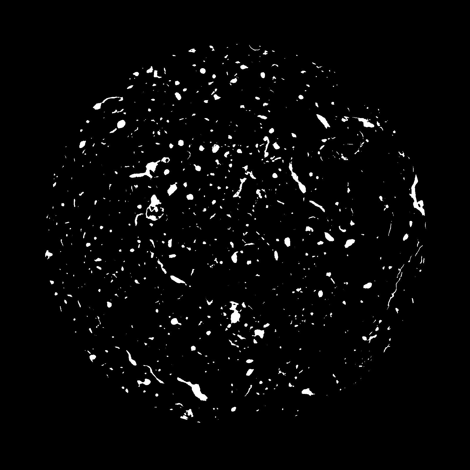
|
|---|
|
| XY Plane Grey |
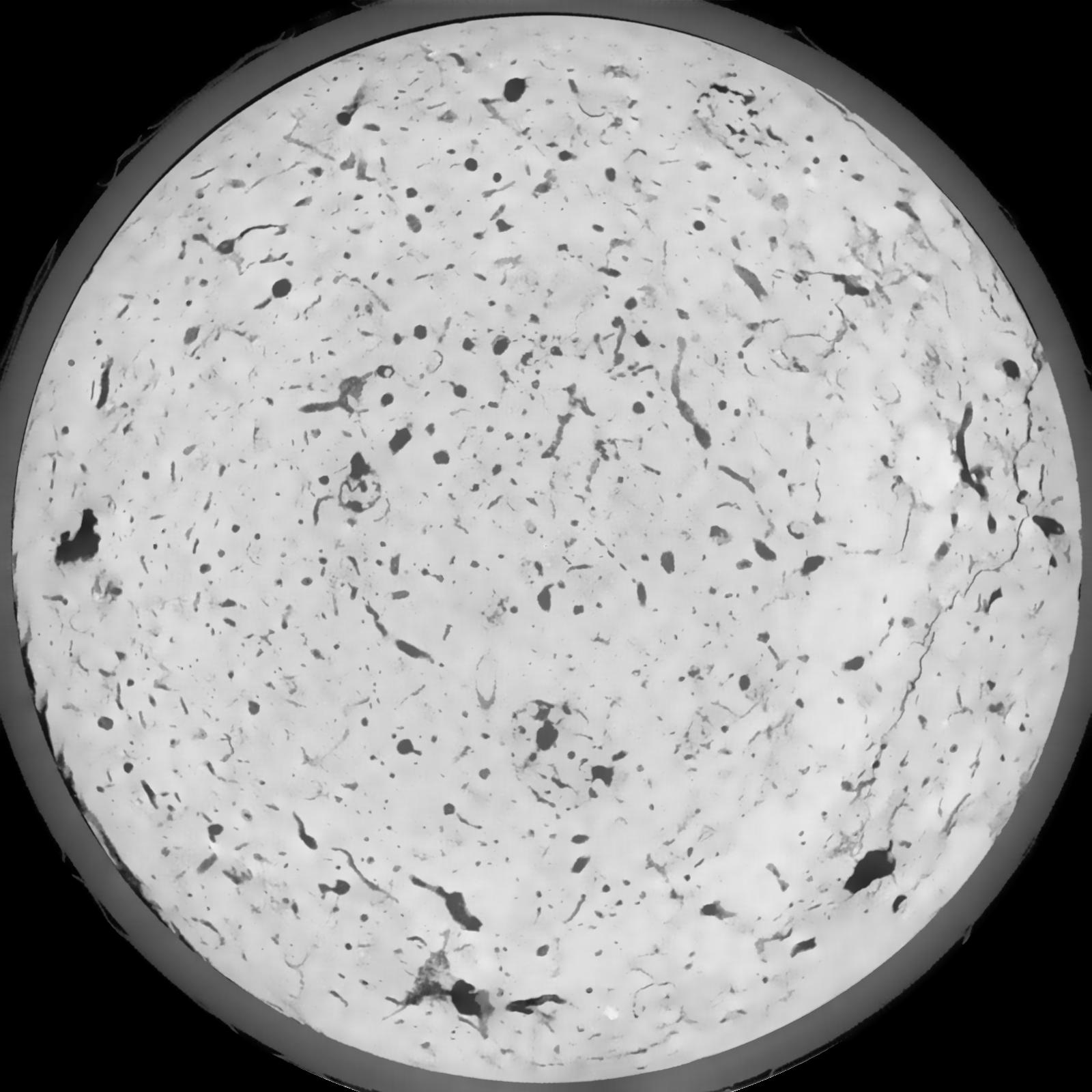
|
|---|
|
| Texture | silt loam |
|---|
| Sand | 8.0 |
|---|
| Silt | 79.0 |
|---|
| Clay | 13.0 |
|---|
|
|
Results
| Porosity | Surface | Mean Curvature | Euler | MeanPoreSize | Gamma | PoreDist |
| 0.04115 | 0.386333333 | 0.215944444 | 0.366805556 | 0.0 | 0.4608 | 0.526269463 |
| Opening size | Volume | Surface | MeanCurvature | Euler number |
|---|
| 0.12 | 0.04115 | 0.386333333 | 0.215944444 | 0.366805556 |
| 0.15 | 0.03896 | 0.3275 | 0.15075 | 0.154212963 |
| 0.18 | 0.03722 | 0.2925 | 0.121944444 | 0.10037037 |
| 0.21 | 0.03592 | 0.270166667 | 0.10625 | 0.086064815 |
| 0.24 | 0.03531 | 0.261 | 0.103 | 0.099212963 |
| 0.27 | 0.03138 | 0.206333333 | 0.069444444 | 0.055046296 |
| 0.3 | 0.02979 | 0.187666667 | 0.060277778 | 0.048333333 |
| 0.36 | 0.02746 | 0.16175 | 0.049111111 | 0.038088889 |
| 0.42 | 0.02328 | 0.121583333 | 0.032083333 | 0.021878241 |
| 0.48 | 0.02086 | 0.101583333 | 0.025058333 | 0.015996759 |
| 0.54 | 0.01748 | 0.076966667 | 0.017002778 | 0.01072963 |
| 0.6000000000000001 | 0.01585 | 0.066216667 | 0.013980556 | 0.007958333 |
| 0.6599999999999999 | 0.0131 | 0.050016667 | 0.009644444 | 0.006362963 |
| 0.72 | 0.01169 | 0.04195 | 0.007669444 | 0.004028102 |
| 0.78 | 0.009975 | 0.033266667 | 0.005661111 | 0.003101296 |
| 0.8400000000000001 | 0.009217 | 0.029416667 | 0.004836111 | 0.002299213 |
| 0.8999999999999999 | 0.007906 | 0.023483333 | 0.003558333 | 0.001657593 |
| 1.2 | 0.00497 | 0.011953333 | 0.001424444 | 0.000579259 |
| 1.5 | 0.003282 | 0.0069 | 0.000710611 | 0.00025844 |
| 1.8 | 0.002015 | 0.00375 | 0.000343806 | 0.00010694 |
| 2.1 | 0.00123 | 0.002131667 | 0.000186611 | 0.000062384 |
| 2.7 | 0.0005204 | 0.000775333 | 0.000057214 | 0.000017824 |
| 3.3000000000000003 | 0.0001318 | 0.000212167 | 0.00001818 | 0.000004704 |
Reference: An open Soil Structure Library based on X-ray CT data
 Soil Structure Library