General Information
Internal Identifier CG_G2_O_b
| Soil Type | Chernozem |
|---|
| Classification | WRB |
|---|
|
| Location | Bernburg (Westerfeld) |
|---|
| Latitude | 51.820 |
|---|
| Longitude | 11.700 |
|---|
|
| Landuse | agricultural crop rotation |
|---|
| Tillage | reduced tillage |
|---|
| Crop | winter wheat, maize, winter wheat, winter rape, winter barley |
|---|
|
| Sampling Depth | 13.0 |
|---|
| Sample Height | 10.0 |
|---|
| Sampling Date | March 28, 2017 |
|---|
| Voxel size | 0.06 |
|---|
| Pores white? | True |
|---|
|
| XY Plane |
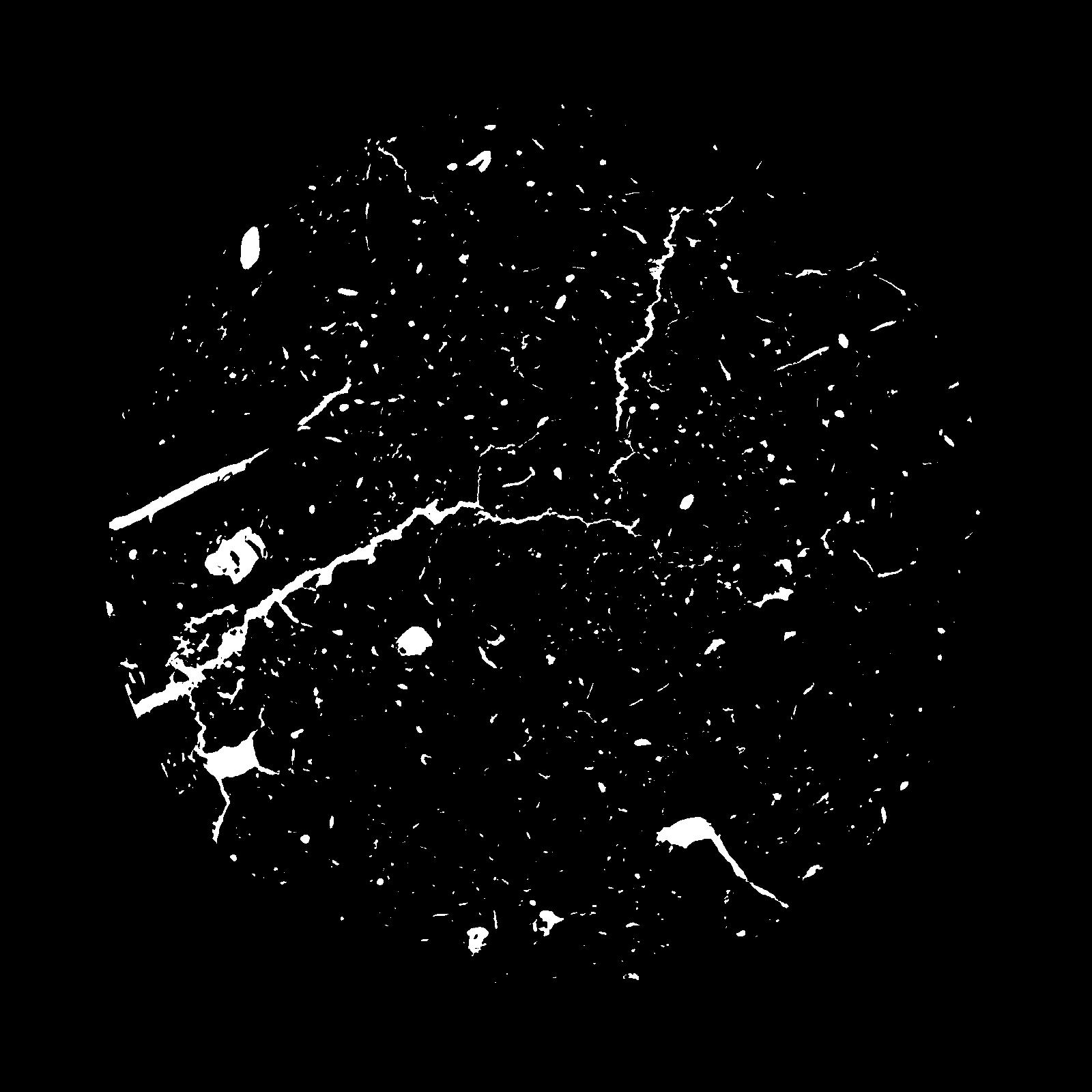
|
|---|
|
| XY Plane Grey |
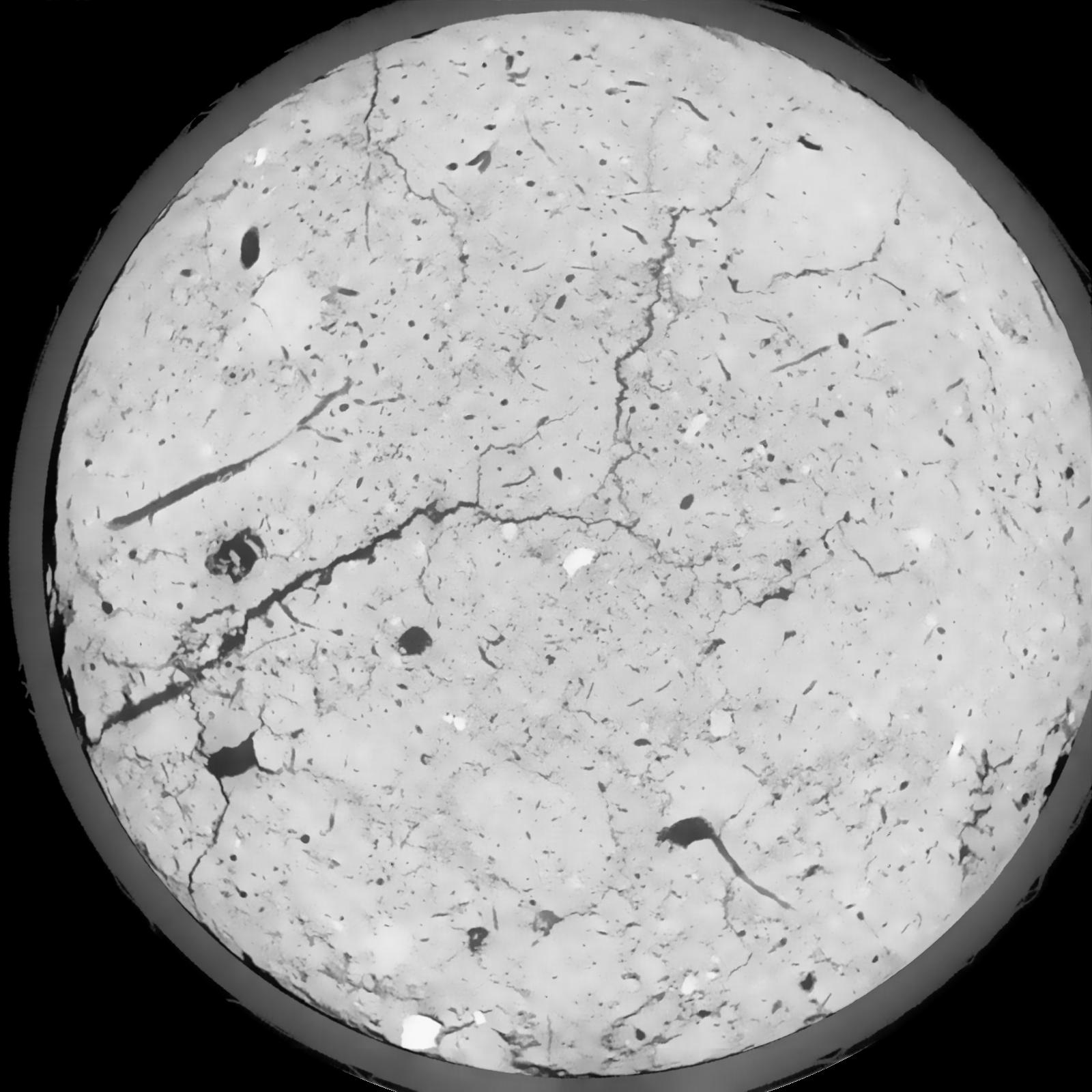
|
|---|
|
| Texture | silt loam |
|---|
| Sand | 8.0 |
|---|
| Silt | 79.0 |
|---|
| Clay | 13.0 |
|---|
|
|
Results
| Porosity | Surface | Mean Curvature | Euler | MeanPoreSize | Gamma | PoreDist |
| 0.05831 | 0.481333333 | 0.227305556 | 0.426018519 | 0.0 | 0.7055 | 0.510558123 |
| Opening size | Volume | Surface | MeanCurvature | Euler number |
|---|
| 0.12 | 0.05831 | 0.481333333 | 0.227305556 | 0.426018519 |
| 0.15 | 0.05571 | 0.406666667 | 0.150388889 | 0.142638889 |
| 0.18 | 0.05348 | 0.363333333 | 0.117 | 0.072962963 |
| 0.21 | 0.05156 | 0.332833333 | 0.09925 | 0.062916667 |
| 0.24 | 0.05066 | 0.32 | 0.096472222 | 0.085185185 |
| 0.27 | 0.04514 | 0.251333333 | 0.062388889 | 0.0349 |
| 0.3 | 0.04272 | 0.225833333 | 0.053055556 | 0.029846759 |
| 0.36 | 0.03961 | 0.194666667 | 0.043 | 0.025355093 |
| 0.42 | 0.03387 | 0.146733333 | 0.027944444 | 0.012877778 |
| 0.48 | 0.03055 | 0.123 | 0.021875 | 0.00911713 |
| 0.54 | 0.02589 | 0.093716667 | 0.014916667 | 0.006372222 |
| 0.6000000000000001 | 0.02369 | 0.081083333 | 0.012302778 | 0.004616481 |
| 0.6599999999999999 | 0.01995 | 0.062133333 | 0.008633333 | 0.003653981 |
| 0.72 | 0.01813 | 0.05305 | 0.006933333 | 0.00231713 |
| 0.78 | 0.0159 | 0.043516667 | 0.005355556 | 0.001925 |
| 0.8400000000000001 | 0.01489 | 0.039183333 | 0.004683333 | 0.00135463 |
| 0.8999999999999999 | 0.01313 | 0.032533333 | 0.003688889 | 0.001122917 |
| 1.2 | 0.008703 | 0.01775 | 0.001677444 | 0.000472361 |
| 1.5 | 0.006012 | 0.010455 | 0.0008315 | 0.000231713 |
| 1.8 | 0.004532 | 0.00718 | 0.000503722 | 0.000098032 |
| 2.1 | 0.003416 | 0.005236667 | 0.00036575 | 0.000080208 |
| 2.7 | 0.001455 | 0.002135 | 0.000154 | 0.000044561 |
| 3.3000000000000003 | 0.0004404 | 0.0006355 | 0.000048125 | 0.000008912 |
Reference: An open Soil Structure Library based on X-ray CT data
 Soil Structure Library