General Information
Internal Identifier CG_G3_U_a
| Soil Type | Chernozem |
|---|
| Classification | WRB |
|---|
|
| Location | Bernburg (Westerfeld) |
|---|
| Latitude | 51.820 |
|---|
| Longitude | 11.700 |
|---|
|
| Landuse | agricultural crop rotation |
|---|
| Tillage | reduced tillage |
|---|
| Crop | winter wheat, maize, winter wheat, winter rape, winter barley |
|---|
|
| Sampling Depth | 28.0 |
|---|
| Sample Height | 10.0 |
|---|
| Sampling Date | March 28, 2017 |
|---|
| Voxel size | 0.06 |
|---|
| Pores white? | True |
|---|
|
| XY Plane |
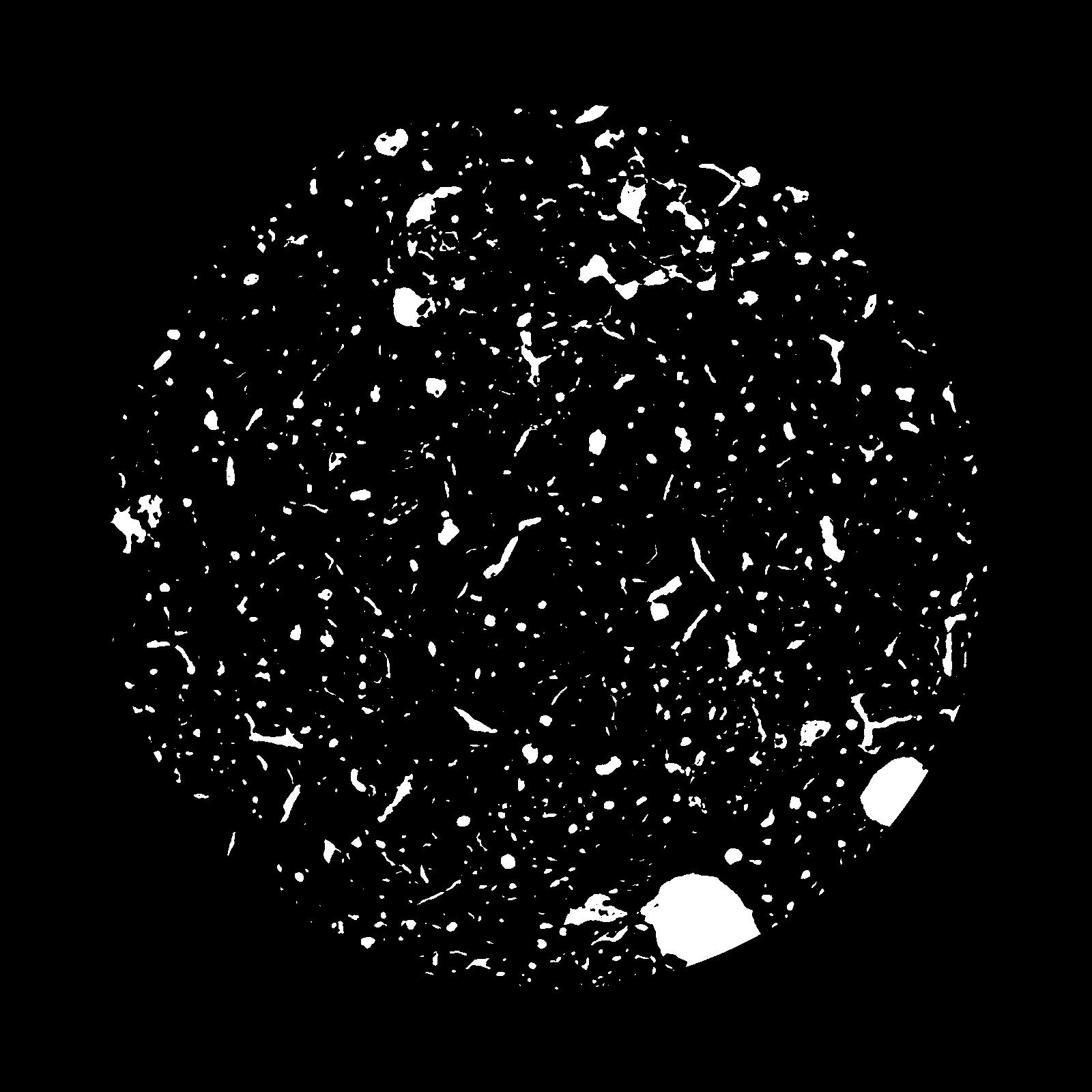
|
|---|
|
| XY Plane Grey |
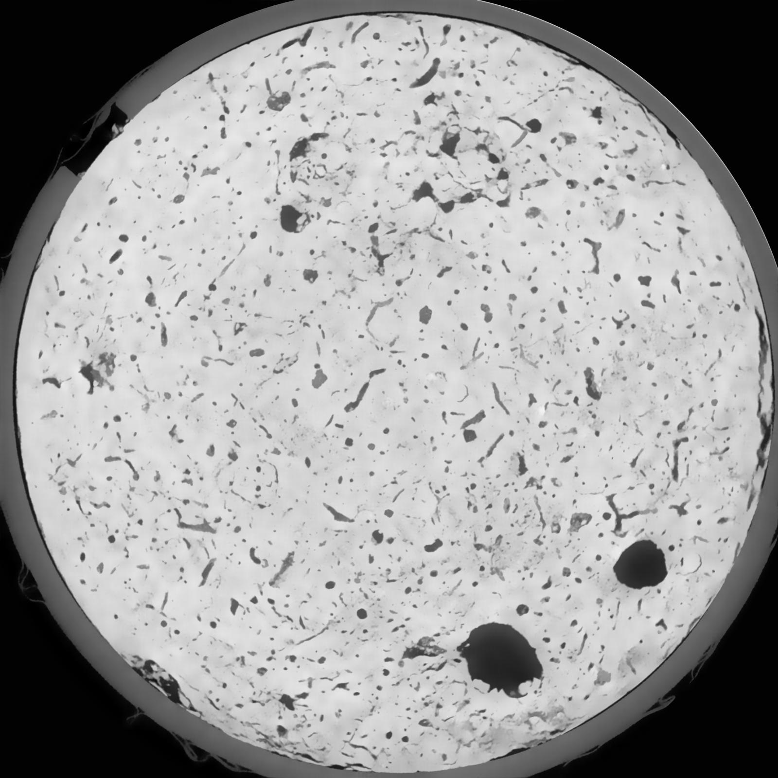
|
|---|
|
| Texture | silt loam |
|---|
| Sand | 8.0 |
|---|
| Silt | 79.0 |
|---|
| Clay | 13.0 |
|---|
|
|
Results
| Porosity | Surface | Mean Curvature | Euler | MeanPoreSize | Gamma | PoreDist |
| 0.07478 | 0.627666667 | 0.307222222 | 0.423611111 | 0.0 | 0.7332 | 0.408291425 |
| Opening size | Volume | Surface | MeanCurvature | Euler number |
|---|
| 0.12 | 0.07478 | 0.627666667 | 0.307222222 | 0.423611111 |
| 0.15 | 0.07221 | 0.5575 | 0.232944444 | 0.171851852 |
| 0.18 | 0.07024 | 0.516333333 | 0.195027778 | 0.107453704 |
| 0.21 | 0.06841 | 0.4845 | 0.172416667 | 0.096296296 |
| 0.24 | 0.06751 | 0.470833333 | 0.167888889 | 0.124398148 |
| 0.27 | 0.06138 | 0.388 | 0.119861111 | 0.07037037 |
| 0.3 | 0.05848 | 0.354833333 | 0.104916667 | 0.064166667 |
| 0.36 | 0.05413 | 0.307833333 | 0.086277778 | 0.055648148 |
| 0.42 | 0.04628 | 0.236166667 | 0.058972222 | 0.033802315 |
| 0.48 | 0.04145 | 0.198166667 | 0.047 | 0.025256019 |
| 0.54 | 0.0344 | 0.149466667 | 0.032861111 | 0.019133333 |
| 0.6000000000000001 | 0.03081 | 0.126516667 | 0.026861111 | 0.0141875 |
| 0.6599999999999999 | 0.02474 | 0.091766667 | 0.018197222 | 0.011834722 |
| 0.72 | 0.02171 | 0.074683333 | 0.014219444 | 0.007548148 |
| 0.78 | 0.0179 | 0.0555 | 0.009863889 | 0.005658796 |
| 0.8400000000000001 | 0.01622 | 0.046966667 | 0.008030556 | 0.004045926 |
| 0.8999999999999999 | 0.01352 | 0.034616667 | 0.005391667 | 0.002816111 |
| 1.2 | 0.008405 | 0.01387 | 0.001385417 | 0.00057037 |
| 1.5 | 0.006602 | 0.008345 | 0.000571056 | 0.00021388 |
| 1.8 | 0.00565 | 0.006155 | 0.000345417 | 0.000124764 |
| 2.1 | 0.004998 | 0.004843333 | 0.000210139 | 0.000071292 |
| 2.7 | 0.004119 | 0.00366 | 0.000146508 | 0.000035647 |
| 3.3000000000000003 | 0.003436 | 0.002875 | 0.000107475 | 0.000008912 |
| 3.9 | 0.002809 | 0.002405 | 0.000098919 | 0.000017824 |
| 4.5 | 0.001674 | 0.001349 | 0.000056144 | 0.000008912 |
| 5.1 | 0.001252 | 0.000975167 | 0.000039033 | 0.00000471 |
| 5.699999999999999 | 0.001013 | 0.000821167 | 0.000035292 | 0.00000471 |
| 6.3 | 0.0005851 | 0.0004565 | 0.000018715 | 0.000002355 |
Reference: An open Soil Structure Library based on X-ray CT data
 Soil Structure Library