General Information
Internal Identifier AM_NAU_PE_D10_4a
| Soil Type | Regosols |
|---|
| Classification | WRB |
|---|
|
| Location | Nauen |
|---|
| Latitude | 52.619604 |
|---|
| Longitude | 12.786917 |
|---|
|
| Landuse | Grassland |
|---|
| Tillage | no tillage |
|---|
| Crop | Mustard |
|---|
|
| Sampling Depth | 10.0 |
|---|
| Sample Height | 5.0 |
|---|
| Sampling Date | Oct. 16, 2024 |
|---|
| Voxel size | 0.03 |
|---|
| Pores white? | True |
|---|
|
| XY Plane |
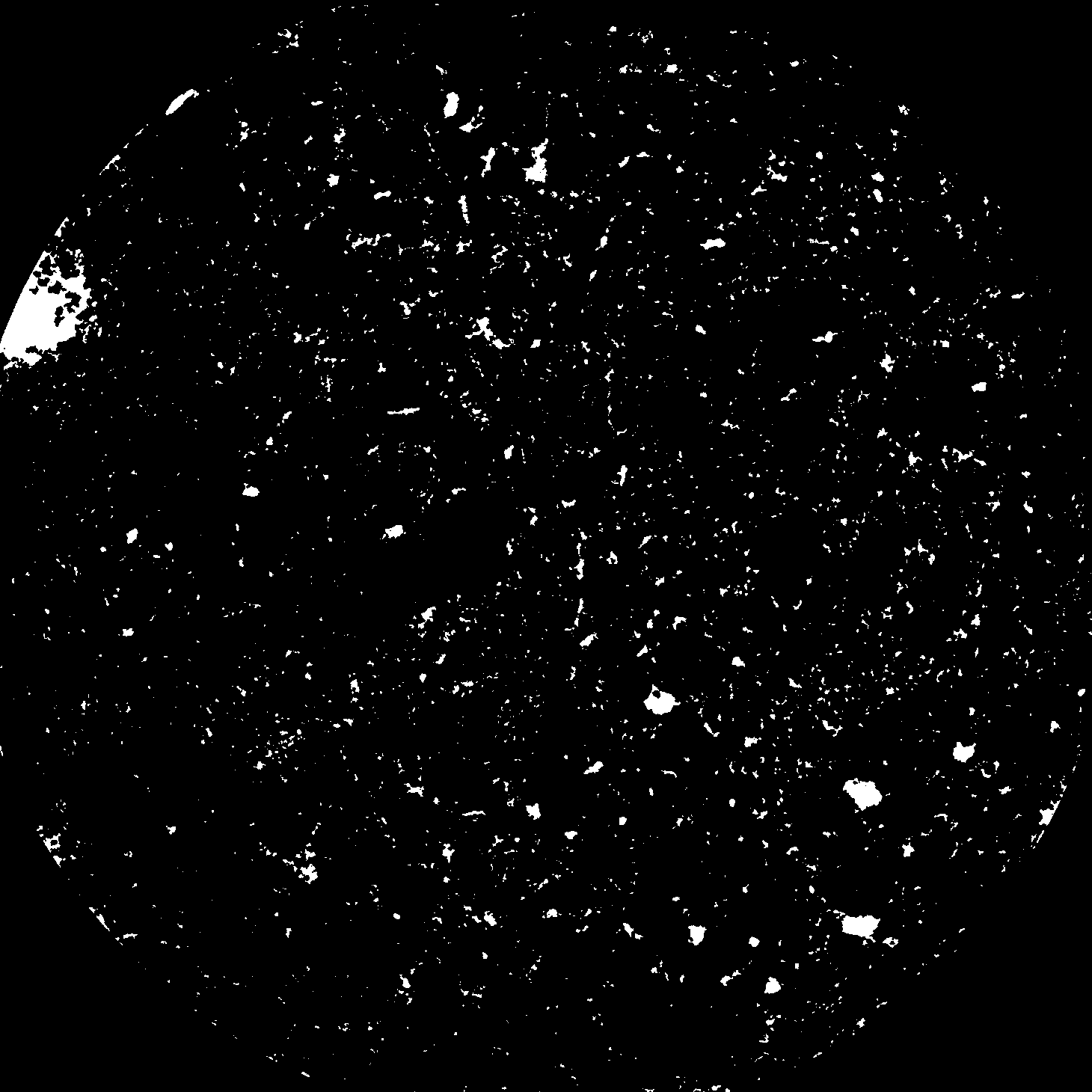
|
|---|
|
| XY Plane Grey |
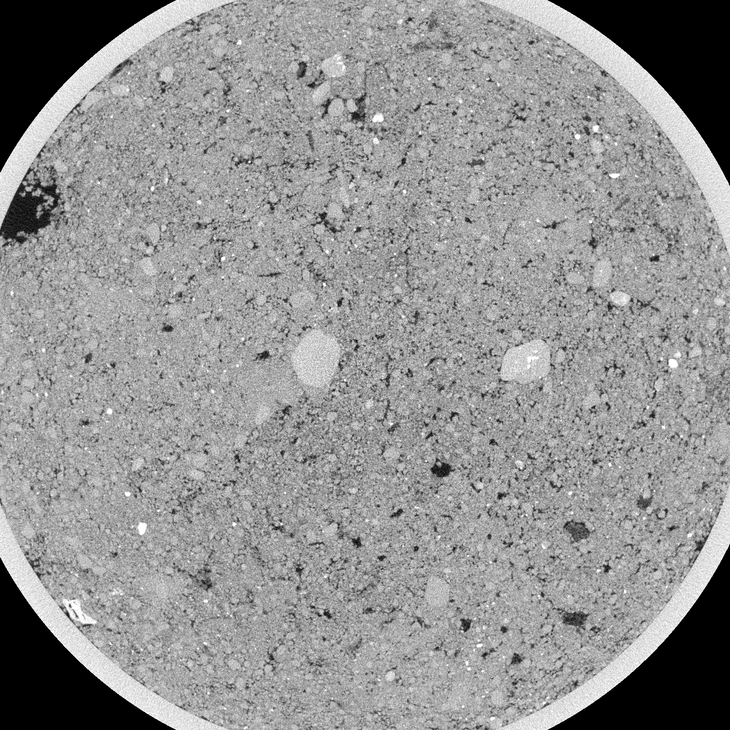
|
|---|
|
| Texture | Sandy loam |
|---|
| Sand | 74.4738 |
|---|
| Silt | 16.95417 |
|---|
| Clay | 8.57203 |
|---|
|
|
Reference: An open Soil Structure Library based on X-ray CT data
 Soil Structure Library