General Information
Internal Identifier CG_G4_O_b
| Soil Type | Chernozem |
|---|
| Classification | WRB |
|---|
|
| Location | Bernburg (Westerfeld) |
|---|
| Latitude | 51.820 |
|---|
| Longitude | 11.700 |
|---|
|
| Landuse | agricultural crop rotation |
|---|
| Tillage | reduced tillage |
|---|
| Crop | winter wheat, maize, winter wheat, winter rape, winter barley |
|---|
|
| Sampling Depth | 13.0 |
|---|
| Sample Height | 10.0 |
|---|
| Sampling Date | March 28, 2017 |
|---|
| Voxel size | 0.06 |
|---|
| Pores white? | True |
|---|
|
| XY Plane |
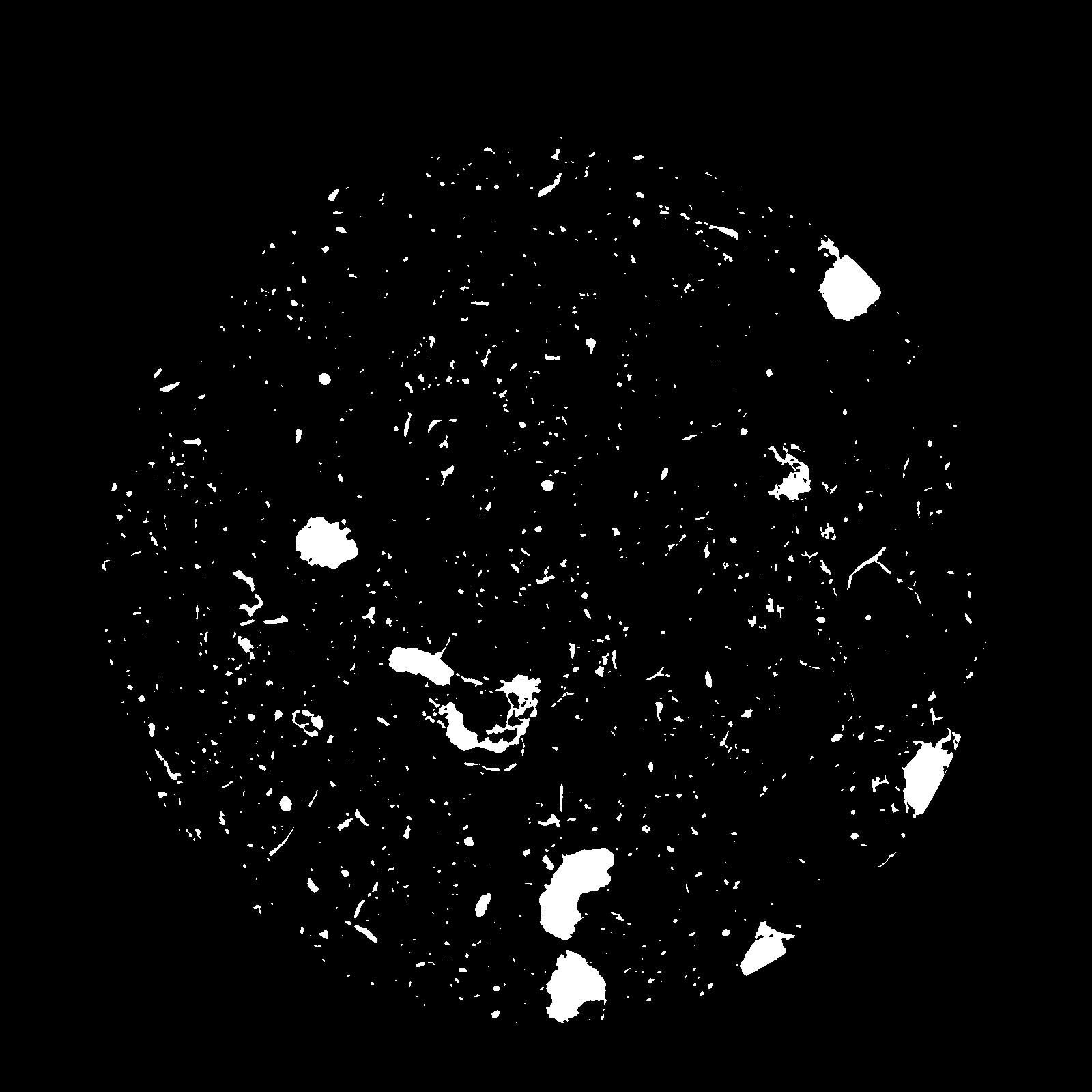
|
|---|
|
| XY Plane Grey |
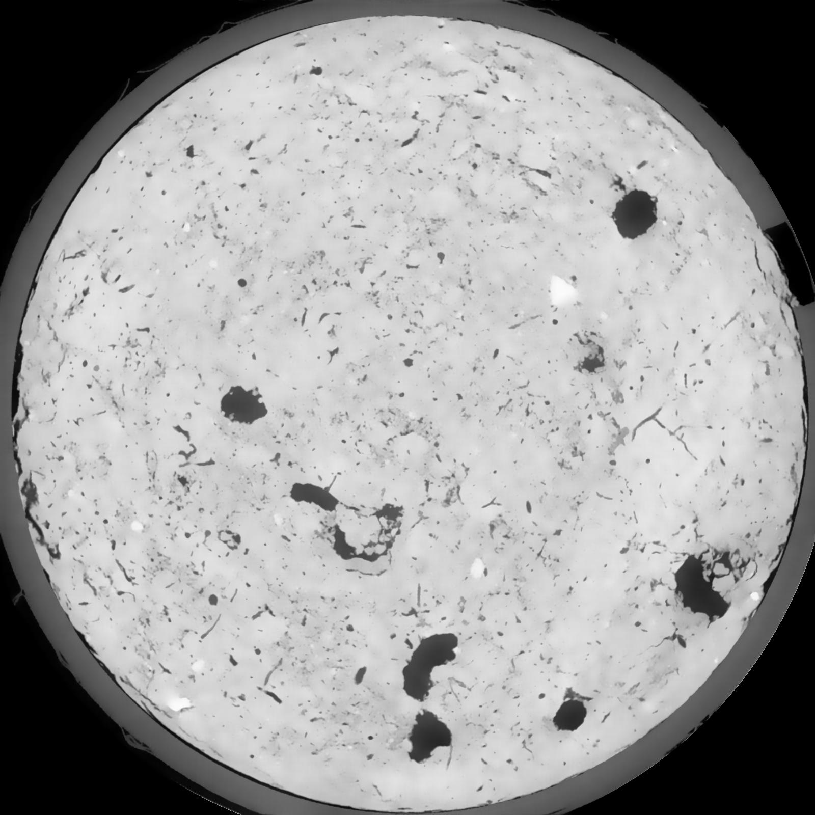
|
|---|
|
| Texture | silt loam |
|---|
| Sand | 8.0 |
|---|
| Silt | 79.0 |
|---|
| Clay | 13.0 |
|---|
|
|
Results
| Porosity | Surface | Mean Curvature | Euler | MeanPoreSize | Gamma | PoreDist |
| 0.05628 | 0.460333333 | 0.27425 | 0.587962963 | 0.0 | 0.6088 | 0.469416453 |
| Opening size | Volume | Surface | MeanCurvature | Euler number |
|---|
| 0.12 | 0.05628 | 0.460333333 | 0.27425 | 0.587962963 |
| 0.15 | 0.0537 | 0.387333333 | 0.184527778 | 0.219351852 |
| 0.18 | 0.0515 | 0.341166667 | 0.141027778 | 0.123796296 |
| 0.21 | 0.0496 | 0.308 | 0.117 | 0.100509259 |
| 0.24 | 0.04874 | 0.295166667 | 0.112888889 | 0.124074074 |
| 0.27 | 0.04346 | 0.222166667 | 0.068027778 | 0.056296296 |
| 0.3 | 0.04125 | 0.1965 | 0.056055556 | 0.04712963 |
| 0.36 | 0.03839 | 0.16525 | 0.043277778 | 0.036083333 |
| 0.42 | 0.03363 | 0.120866667 | 0.025533333 | 0.017564815 |
| 0.48 | 0.0311 | 0.100766667 | 0.018908333 | 0.011291204 |
| 0.54 | 0.02788 | 0.0786 | 0.012344444 | 0.006968981 |
| 0.6000000000000001 | 0.02647 | 0.069833333 | 0.010136111 | 0.004856944 |
| 0.6599999999999999 | 0.02425 | 0.05795 | 0.00745 | 0.003894398 |
| 0.72 | 0.02312 | 0.052016667 | 0.006208333 | 0.002370509 |
| 0.78 | 0.02166 | 0.045533333 | 0.005002778 | 0.002005139 |
| 0.8400000000000001 | 0.02095 | 0.0423 | 0.004422222 | 0.001354583 |
| 0.8999999999999999 | 0.01962 | 0.036966667 | 0.003525 | 0.001185278 |
| 1.2 | 0.01626 | 0.025666667 | 0.001930278 | 0.000579259 |
| 1.5 | 0.01388 | 0.0196 | 0.001280611 | 0.000338644 |
| 1.8 | 0.01199 | 0.015858333 | 0.000998278 | 0.000231704 |
| 2.1 | 0.009882 | 0.012083333 | 0.000725056 | 0.000222792 |
| 2.7 | 0.007069 | 0.007705 | 0.000406917 | 0.000071292 |
| 3.3000000000000003 | 0.004642 | 0.004623333 | 0.000229922 | 0.000044558 |
| 3.9 | 0.002827 | 0.002508333 | 0.000111217 | 0.000017824 |
| 4.5 | 0.00156 | 0.001207333 | 0.000045983 | 0.000008912 |
| 5.1 | 0.001258 | 0.001008833 | 0.000041172 | 0.000008912 |
| 5.699999999999999 | 0.0009537 | 0.0008075 | 0.000035825 | 0.000004726 |
| 6.3 | 0.0003602 | 0.000326667 | 0.000015506 | 0.000002363 |
Reference: An open Soil Structure Library based on X-ray CT data
 Soil Structure Library