General Information
Internal Identifier AM_ROE_PE_D10_4a
| Soil Type | Regosols |
|---|
| Classification | WRB |
|---|
|
| Location | Rödensdorf |
|---|
| Latitude | 49.88925 |
|---|
| Longitude | 11.574194 |
|---|
|
| Landuse | Grassland |
|---|
| Tillage | no tillage |
|---|
| Crop | Wheat |
|---|
|
| Sampling Depth | 10.0 |
|---|
| Sample Height | 5.0 |
|---|
| Sampling Date | April 15, 2025 |
|---|
| Voxel size | 0.03 |
|---|
| Pores white? | True |
|---|
|
| XY Plane |
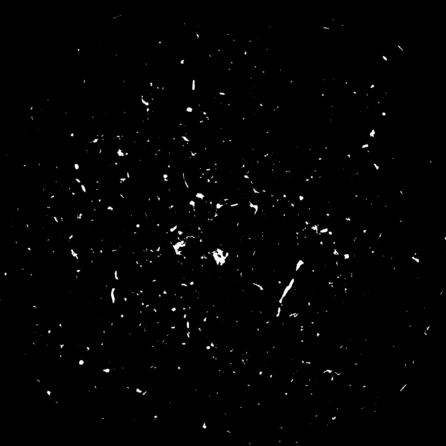
|
|---|
|
| XY Plane Grey |
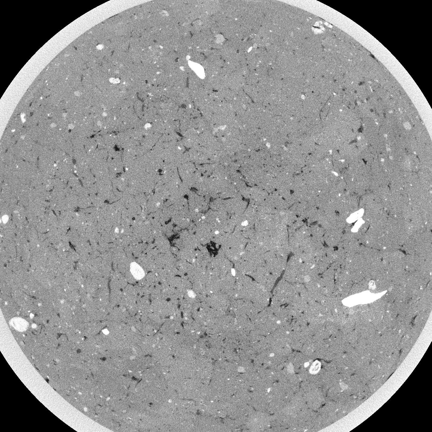
|
|---|
|
| Texture | Clay |
|---|
| Sand | 14.8589 |
|---|
| Silt | 24.3342 |
|---|
| Clay | 60.8069 |
|---|
|
|
Reference: An open Soil Structure Library based on X-ray CT data
 Soil Structure Library