General Information
Internal Identifier CG_P1_O_b
| Soil Type | Chernozem |
|---|
| Classification | WRB |
|---|
|
| Location | Bernburg (Westerfeld) |
|---|
| Latitude | 51.820 |
|---|
| Longitude | 11.700 |
|---|
|
| Landuse | agricultural crop rotation |
|---|
| Tillage | conventional tillage |
|---|
| Crop | winter wheat, maize, winter wheat, winter rape, winter barley |
|---|
|
| Sampling Depth | 13.0 |
|---|
| Sample Height | 10.0 |
|---|
| Sampling Date | March 28, 2017 |
|---|
| Voxel size | 0.06 |
|---|
| Pores white? | True |
|---|
|
| XY Plane |
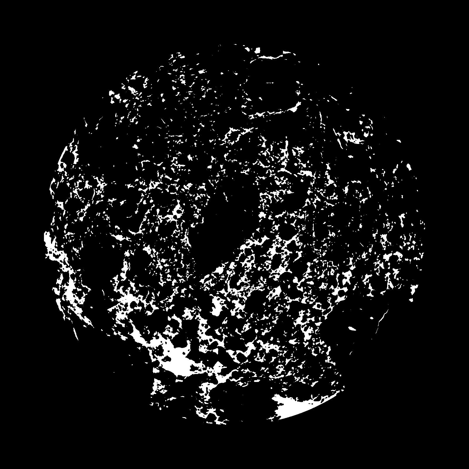
|
|---|
|
| XY Plane Grey |
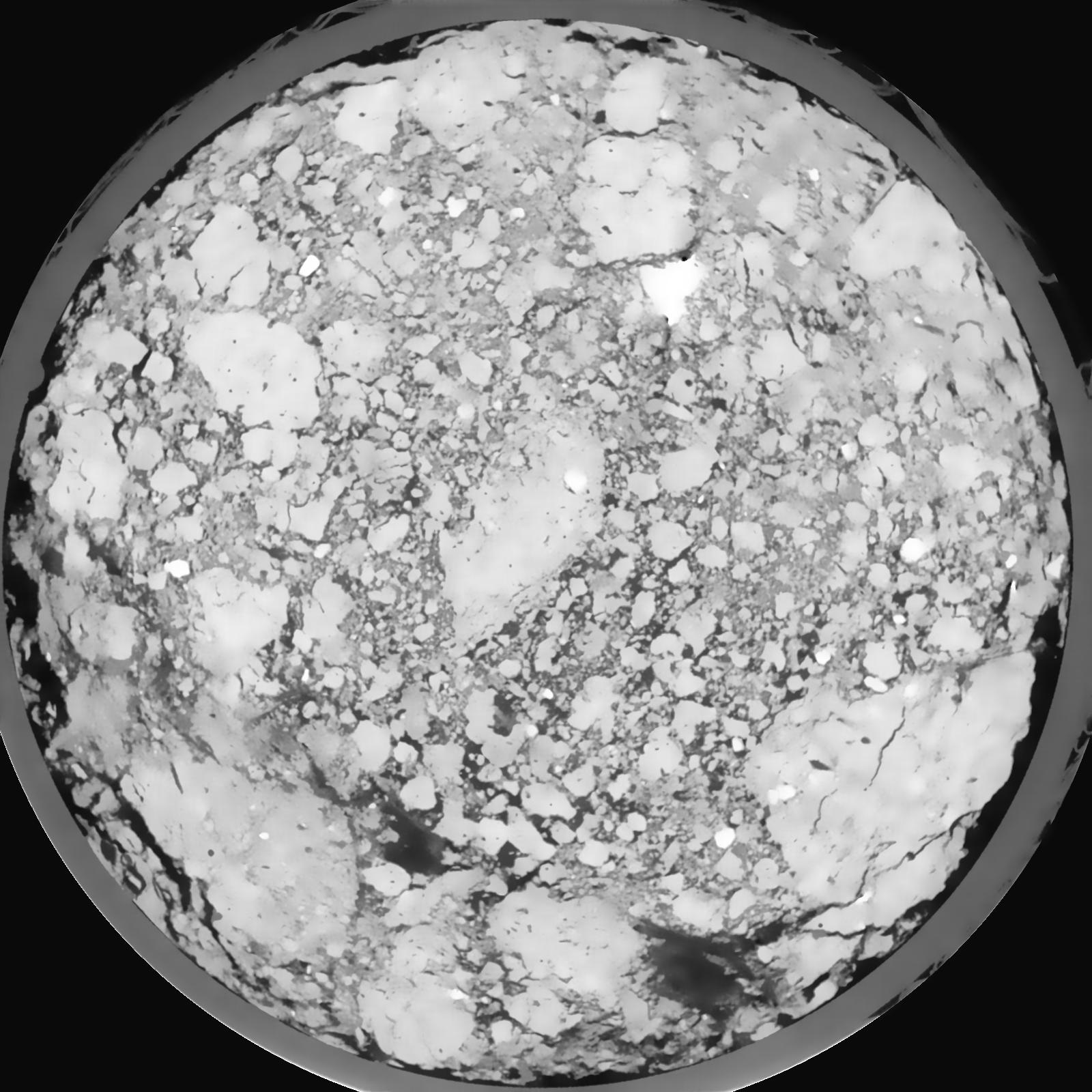
|
|---|
|
| Texture | silt loam |
|---|
| Sand | 8.0 |
|---|
| Silt | 79.0 |
|---|
| Clay | 13.0 |
|---|
|
|
Results
| Porosity | Surface | Mean Curvature | Euler | MeanPoreSize | Gamma | PoreDist |
| 0.1648 | 1.2285 | 0.344444444 | -0.245972222 | 0.0 | 0.9068 | 0.413457889 |
| Opening size | Volume | Surface | MeanCurvature | Euler number |
|---|
| 0.12 | 0.1648 | 1.2285 | 0.344444444 | -0.245972222 |
| 0.15 | 0.161 | 1.104833333 | 0.257694444 | -0.281574074 |
| 0.18 | 0.157 | 1.035166667 | 0.222444444 | -0.282268519 |
| 0.21 | 0.1529 | 0.977 | 0.20275 | -0.199490741 |
| 0.24 | 0.1504 | 0.9435 | 0.202916667 | -0.075231481 |
| 0.27 | 0.1348 | 0.7755 | 0.160388889 | -0.04712963 |
| 0.3 | 0.1266 | 0.697166667 | 0.144694444 | -0.004277639 |
| 0.36 | 0.1155 | 0.592333333 | 0.12375 | 0.046189352 |
| 0.42 | 0.09396 | 0.418666667 | 0.081055556 | 0.041091667 |
| 0.48 | 0.08202 | 0.3335 | 0.061111111 | 0.03242963 |
| 0.54 | 0.06679 | 0.235666667 | 0.037527778 | 0.021120833 |
| 0.6000000000000001 | 0.06038 | 0.198166667 | 0.0295 | 0.015141204 |
| 0.6599999999999999 | 0.04997 | 0.144383333 | 0.018619444 | 0.008947222 |
| 0.72 | 0.04546 | 0.121966667 | 0.014505556 | 0.006024537 |
| 0.78 | 0.03978 | 0.09785 | 0.0106 | 0.004099398 |
| 0.8400000000000001 | 0.03742 | 0.087866667 | 0.009061111 | 0.003163657 |
| 0.8999999999999999 | 0.03298 | 0.071333333 | 0.006666667 | 0.002120972 |
| 1.2 | 0.02222 | 0.03805 | 0.002855556 | 0.000677269 |
| 1.5 | 0.01557 | 0.022183333 | 0.00147525 | 0.000338644 |
| 1.8 | 0.0115 | 0.014045 | 0.000876917 | 0.000204968 |
| 2.1 | 0.008546 | 0.00844 | 0.000417611 | 0.000098028 |
| 2.7 | 0.006067 | 0.004576667 | 0.000131536 | 0.000017824 |
| 3.3000000000000003 | 0.005049 | 0.003598333 | 0.000093039 | 0.000004716 |
| 3.9 | 0.003855 | 0.002748333 | 0.0000786 | 0.000004716 |
| 4.5 | 0.002795 | 0.002 | 0.000059886 | 0.000002358 |
| 5.1 | 0.00196 | 0.001477333 | 0.000052936 | 0.000004716 |
| 5.699999999999999 | 0.001184 | 0.000891667 | 0.000031014 | 0.000002358 |
Reference: An open Soil Structure Library based on X-ray CT data
 Soil Structure Library