General Information
Internal Identifier CG_P2_O_a
| Soil Type | Chernozem |
|---|
| Classification | WRB |
|---|
|
| Location | Bernburg (Westerfeld) |
|---|
| Latitude | 51.820 |
|---|
| Longitude | 11.700 |
|---|
|
| Landuse | agricultural crop rotation |
|---|
| Tillage | conventional tillage |
|---|
| Crop | winter wheat, maize, winter wheat, winter rape, winter barley |
|---|
|
| Sampling Depth | 13.0 |
|---|
| Sample Height | 10.0 |
|---|
| Sampling Date | March 28, 2017 |
|---|
| Voxel size | 0.06 |
|---|
| Pores white? | True |
|---|
|
| XY Plane |
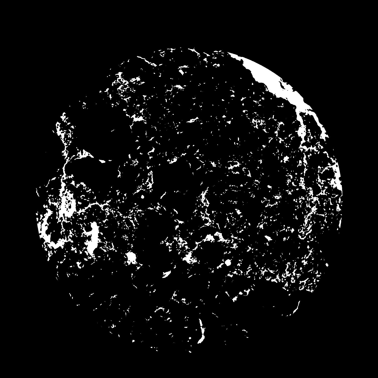
|
|---|
|
| XY Plane Grey |
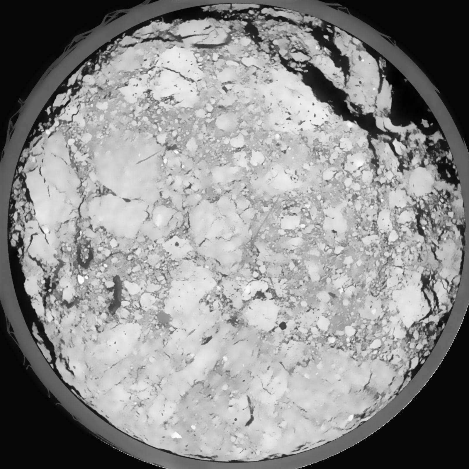
|
|---|
|
| Texture | silt loam |
|---|
| Sand | 8.0 |
|---|
| Silt | 79.0 |
|---|
| Clay | 13.0 |
|---|
|
|
Results
| Porosity | Surface | Mean Curvature | Euler | MeanPoreSize | Gamma | PoreDist |
| 0.1402 | 1.332 | 0.503888889 | -0.088888889 | 0.0 | 0.8451 | 0.337619737 |
| Opening size | Volume | Surface | MeanCurvature | Euler number |
|---|
| 0.12 | 0.1402 | 1.332 | 0.503888889 | -0.088888889 |
| 0.15 | 0.1345 | 1.1535 | 0.354444444 | -0.264212963 |
| 0.18 | 0.1283 | 1.044166667 | 0.293611111 | -0.277314815 |
| 0.21 | 0.1222 | 0.954333333 | 0.258555556 | -0.164675926 |
| 0.24 | 0.1187 | 0.907333333 | 0.257416667 | 0.002352685 |
| 0.27 | 0.09793 | 0.669666667 | 0.180555556 | 0.013331944 |
| 0.3 | 0.08806 | 0.570333333 | 0.15375 | 0.048333333 |
| 0.36 | 0.07659 | 0.456333333 | 0.123333333 | 0.081898148 |
| 0.42 | 0.05617 | 0.2765 | 0.065 | 0.050046296 |
| 0.48 | 0.04691 | 0.204833333 | 0.043027778 | 0.031948611 |
| 0.54 | 0.03666 | 0.13375 | 0.021958333 | 0.014909259 |
| 0.6000000000000001 | 0.03292 | 0.1109 | 0.016238889 | 0.009597685 |
| 0.6599999999999999 | 0.02725 | 0.0811 | 0.009661111 | 0.004669907 |
| 0.72 | 0.02489 | 0.069666667 | 0.007605556 | 0.002771528 |
| 0.78 | 0.02183 | 0.05725 | 0.005769444 | 0.001826898 |
| 0.8400000000000001 | 0.02052 | 0.052 | 0.005058333 | 0.001274352 |
| 0.8999999999999999 | 0.01808 | 0.0435 | 0.004016667 | 0.000917917 |
| 1.2 | 0.0114 | 0.023616667 | 0.002026528 | 0.00036538 |
| 1.5 | 0.007079 | 0.01296 | 0.001068861 | 0.000276264 |
| 1.8 | 0.004222 | 0.006878333 | 0.000526667 | 0.000115852 |
| 2.1 | 0.00257 | 0.003671667 | 0.000243289 | 0.000044558 |
| 2.7 | 0.001154 | 0.001379833 | 0.000073789 | 0.000008912 |
| 3.3000000000000003 | 0.0005563 | 0.000626333 | 0.000033686 | 0.000004732 |
| 3.9 | 0.0002028 | 0.000232667 | 0.000013368 | 0.000002366 |
Reference: An open Soil Structure Library based on X-ray CT data
 Soil Structure Library