General Information
Internal Identifier CG_P2_U_b
| Soil Type | Chernozem |
|---|
| Classification | WRB |
|---|
|
| Location | Bernburg (Westerfeld) |
|---|
| Latitude | 51.820 |
|---|
| Longitude | 11.700 |
|---|
|
| Landuse | agricultural crop rotation |
|---|
| Tillage | conventional tillage |
|---|
| Crop | winter wheat, maize, winter wheat, winter rape, winter barley |
|---|
|
| Sampling Depth | 28.0 |
|---|
| Sample Height | 10.0 |
|---|
| Sampling Date | March 28, 2017 |
|---|
| Voxel size | 0.06 |
|---|
| Pores white? | True |
|---|
|
| XY Plane |
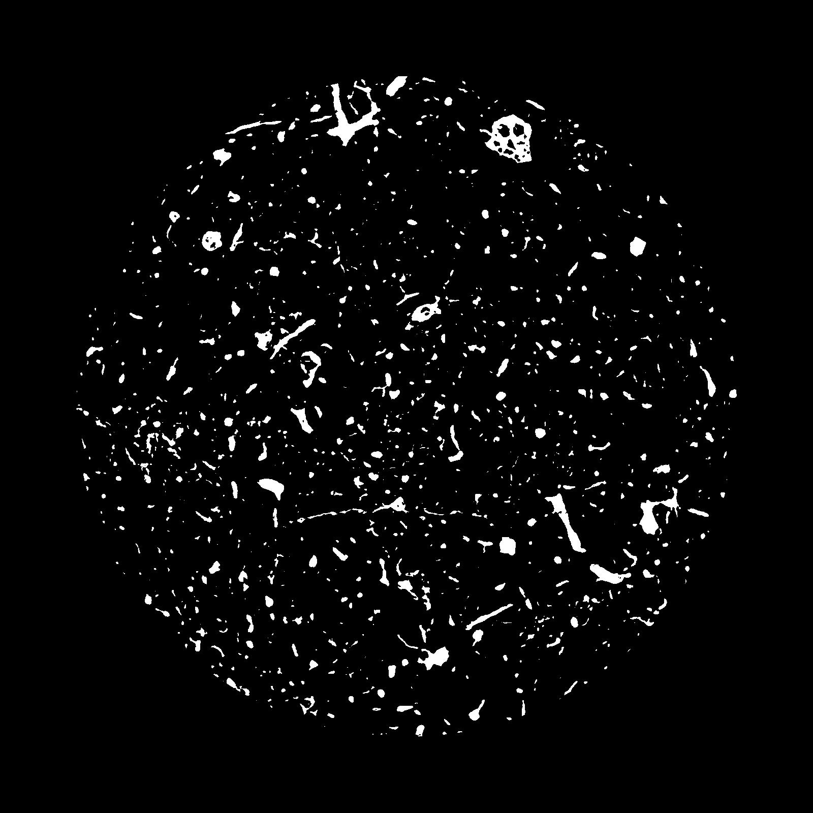
|
|---|
|
| XY Plane Grey |
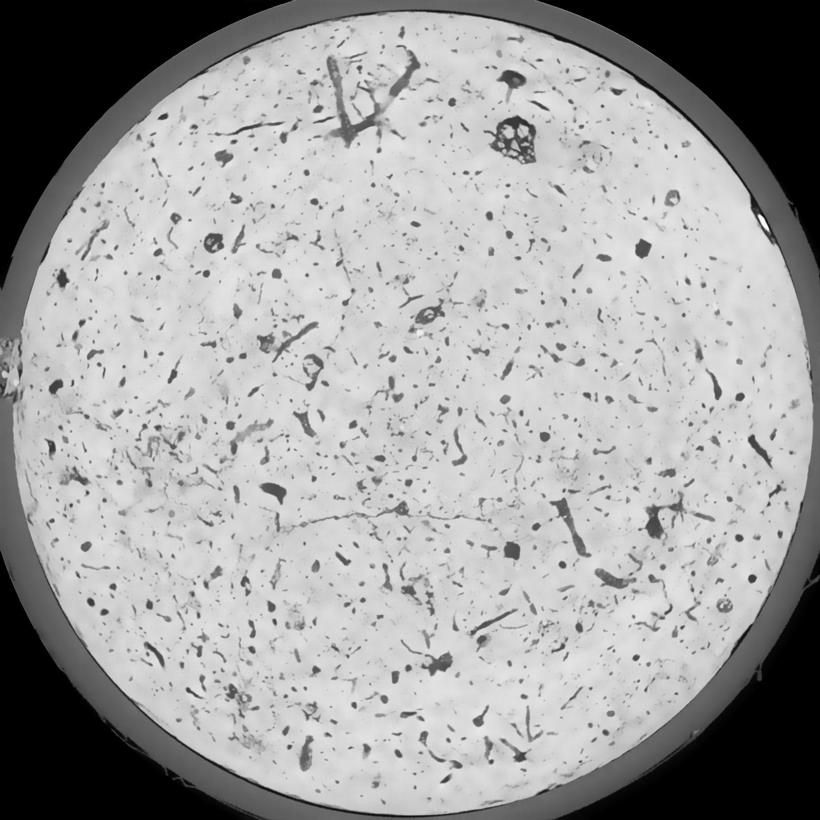
|
|---|
|
| Texture | silt loam |
|---|
| Sand | 8.0 |
|---|
| Silt | 79.0 |
|---|
| Clay | 13.0 |
|---|
|
|
Results
| Porosity | Surface | Mean Curvature | Euler | MeanPoreSize | Gamma | PoreDist |
| 0.0682 | 0.578666667 | 0.286111111 | 0.431388889 | 0.0 | 0.7443 | 0.434509474 |
| Opening size | Volume | Surface | MeanCurvature | Euler number |
|---|
| 0.12 | 0.0682 | 0.578666667 | 0.286111111 | 0.431388889 |
| 0.15 | 0.06577 | 0.511833333 | 0.2125 | 0.16787037 |
| 0.18 | 0.06381 | 0.471166667 | 0.175305556 | 0.101018519 |
| 0.21 | 0.06201 | 0.440166667 | 0.153388889 | 0.088287037 |
| 0.24 | 0.06114 | 0.427166667 | 0.149277778 | 0.11462963 |
| 0.27 | 0.05523 | 0.348166667 | 0.104444444 | 0.061018519 |
| 0.3 | 0.05248 | 0.317166667 | 0.090888889 | 0.055462963 |
| 0.36 | 0.04844 | 0.274 | 0.074388889 | 0.047916667 |
| 0.42 | 0.04098 | 0.207333333 | 0.049916667 | 0.027349537 |
| 0.48 | 0.03641 | 0.172166667 | 0.039444444 | 0.020880093 |
| 0.54 | 0.02975 | 0.126566667 | 0.026447222 | 0.01445463 |
| 0.6000000000000001 | 0.0265 | 0.106 | 0.021269444 | 0.010827778 |
| 0.6599999999999999 | 0.02131 | 0.07685 | 0.014269444 | 0.008653241 |
| 0.72 | 0.01879 | 0.062983333 | 0.011144444 | 0.005578704 |
| 0.78 | 0.01569 | 0.047833333 | 0.007858333 | 0.004081528 |
| 0.8400000000000001 | 0.01432 | 0.041033333 | 0.006469444 | 0.002940833 |
| 0.8999999999999999 | 0.01208 | 0.03105 | 0.0044 | 0.002005093 |
| 1.2 | 0.007693 | 0.014331667 | 0.00146775 | 0.0005525 |
| 1.5 | 0.005763 | 0.008676667 | 0.000687611 | 0.000240611 |
| 1.8 | 0.004567 | 0.005825 | 0.000370556 | 0.000089116 |
| 2.1 | 0.003843 | 0.004418333 | 0.000245425 | 0.000053468 |
| 2.7 | 0.002928 | 0.002896667 | 0.000126189 | 0.000017823 |
| 3.3000000000000003 | 0.00245 | 0.002416667 | 0.000109078 | 0.000008912 |
| 3.9 | 0.001726 | 0.001673333 | 0.000074858 | 0.000017823 |
| 4.5 | 0.0005583 | 0.000530167 | 0.000023527 | 0.000002399 |
Reference: An open Soil Structure Library based on X-ray CT data
 Soil Structure Library