General Information
Internal Identifier CG_P3_O_a
| Soil Type | Chernozem |
|---|
| Classification | WRB |
|---|
|
| Location | Bernburg (Westerfeld) |
|---|
| Latitude | 51.820 |
|---|
| Longitude | 11.700 |
|---|
|
| Landuse | agricultural crop rotation |
|---|
| Tillage | conventional tillage |
|---|
| Crop | winter wheat, maize, winter wheat, winter rape, winter barley |
|---|
|
| Sampling Depth | 13.0 |
|---|
| Sample Height | 10.0 |
|---|
| Sampling Date | March 28, 2017 |
|---|
| Voxel size | 0.06 |
|---|
| Pores white? | True |
|---|
|
| XY Plane |
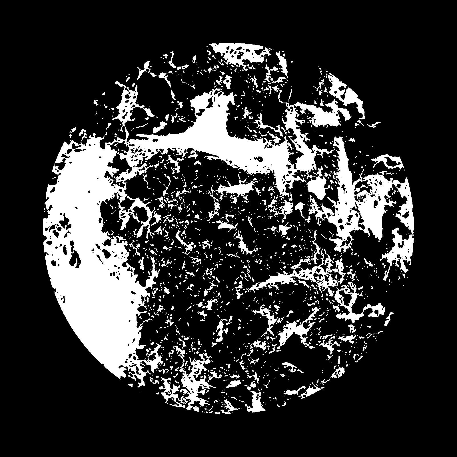
|
|---|
|
| XY Plane Grey |
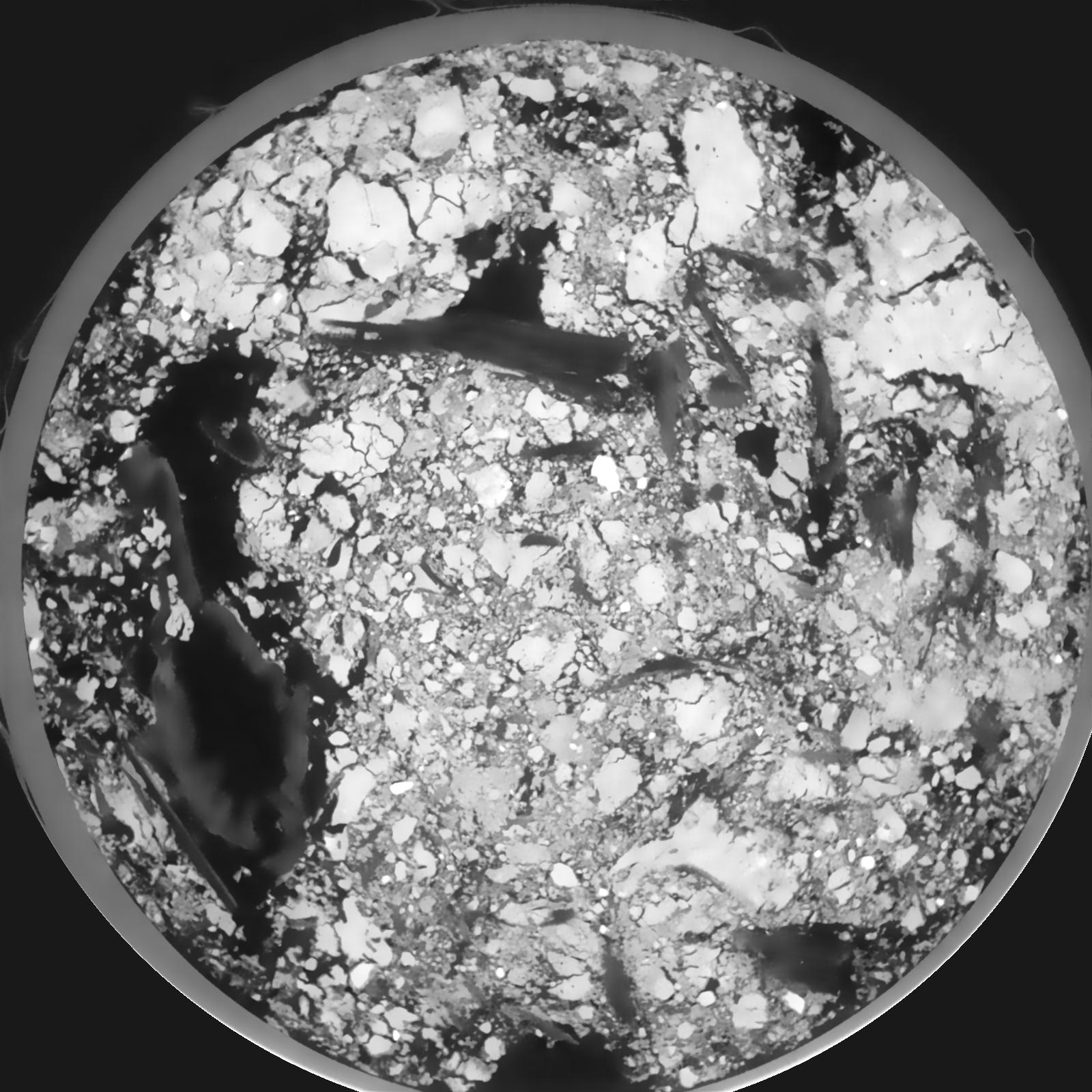
|
|---|
|
| Texture | silt loam |
|---|
| Sand | 8.0 |
|---|
| Silt | 79.0 |
|---|
| Clay | 13.0 |
|---|
|
|
Results
| Porosity | Surface | Mean Curvature | Euler | MeanPoreSize | Gamma | PoreDist |
| 0.1903 | 0.973333333 | 0.196166667 | -0.128009259 | 0.0 | 0.9468 | 0.655334634 |
| Opening size | Volume | Surface | MeanCurvature | Euler number |
|---|
| 0.12 | 0.1903 | 0.973333333 | 0.196166667 | -0.128009259 |
| 0.15 | 0.1877 | 0.880666667 | 0.134166667 | -0.180416667 |
| 0.18 | 0.1848 | 0.83 | 0.109638889 | -0.195601852 |
| 0.21 | 0.1819 | 0.789666667 | 0.096611111 | -0.148564815 |
| 0.24 | 0.1802 | 0.767333333 | 0.097083333 | -0.071064815 |
| 0.27 | 0.1695 | 0.657333333 | 0.074305556 | -0.076018519 |
| 0.3 | 0.1639 | 0.607333333 | 0.067472222 | -0.049861111 |
| 0.36 | 0.1563 | 0.539666667 | 0.059611111 | -0.005374074 |
| 0.42 | 0.1403 | 0.424833333 | 0.043055556 | 0.001416991 |
| 0.48 | 0.1307 | 0.365166667 | 0.03575 | 0.004019306 |
| 0.54 | 0.1172 | 0.290833333 | 0.025680556 | 0.006095833 |
| 0.6000000000000001 | 0.111 | 0.258833333 | 0.021533333 | 0.004482731 |
| 0.6599999999999999 | 0.1 | 0.21 | 0.015811111 | 0.004589676 |
| 0.72 | 0.0948 | 0.187 | 0.013016667 | 0.00297662 |
| 0.78 | 0.08774 | 0.160583333 | 0.010361111 | 0.002664676 |
| 0.8400000000000001 | 0.0846 | 0.1486 | 0.009125 | 0.001889352 |
| 0.8999999999999999 | 0.07859 | 0.129016667 | 0.007336111 | 0.001657639 |
| 1.2 | 0.06192 | 0.083166667 | 0.003830556 | 0.000775324 |
| 1.5 | 0.04966 | 0.057383333 | 0.002323889 | 0.000329745 |
| 1.8 | 0.04093 | 0.042566667 | 0.00171325 | 0.000240625 |
| 2.1 | 0.03385 | 0.031733333 | 0.001192944 | 0.000187153 |
| 2.7 | 0.02485 | 0.020183333 | 0.000693528 | 0.000080208 |
| 3.3000000000000003 | 0.0185 | 0.013555 | 0.000443806 | 0.000062384 |
| 3.9 | 0.01354 | 0.008861667 | 0.000262547 | 0.000026736 |
| 4.5 | 0.01039 | 0.006285 | 0.000176458 | 0.000026736 |
| 5.1 | 0.007614 | 0.003951667 | 0.000080742 | 0.000006746 |
| 5.699999999999999 | 0.006736 | 0.003573333 | 0.000079139 | 0.000004498 |
| 6.3 | 0.005336 | 0.002921667 | 0.000065236 | 0.000008912 |
| 6.8999999999999995 | 0.003295 | 0.001888333 | 0.000054006 | 0.000004498 |
| 7.5 | 0.002472 | 0.001519167 | 0.000048125 | 0.000004498 |
| 8.1 | 0.001134 | 0.0006995 | 0.000022458 | 0.000002248 |
Reference: An open Soil Structure Library based on X-ray CT data
 Soil Structure Library