General Information
Internal Identifier CG_P3_O_b
| Soil Type | Chernozem |
|---|
| Classification | WRB |
|---|
|
| Location | Bernburg (Westerfeld) |
|---|
| Latitude | 51.820 |
|---|
| Longitude | 11.700 |
|---|
|
| Landuse | agricultural crop rotation |
|---|
| Tillage | conventional tillage |
|---|
| Crop | winter wheat, maize, winter wheat, winter rape, winter barley |
|---|
|
| Sampling Depth | 13.0 |
|---|
| Sample Height | 10.0 |
|---|
| Sampling Date | March 28, 2017 |
|---|
| Voxel size | 0.06 |
|---|
| Pores white? | True |
|---|
|
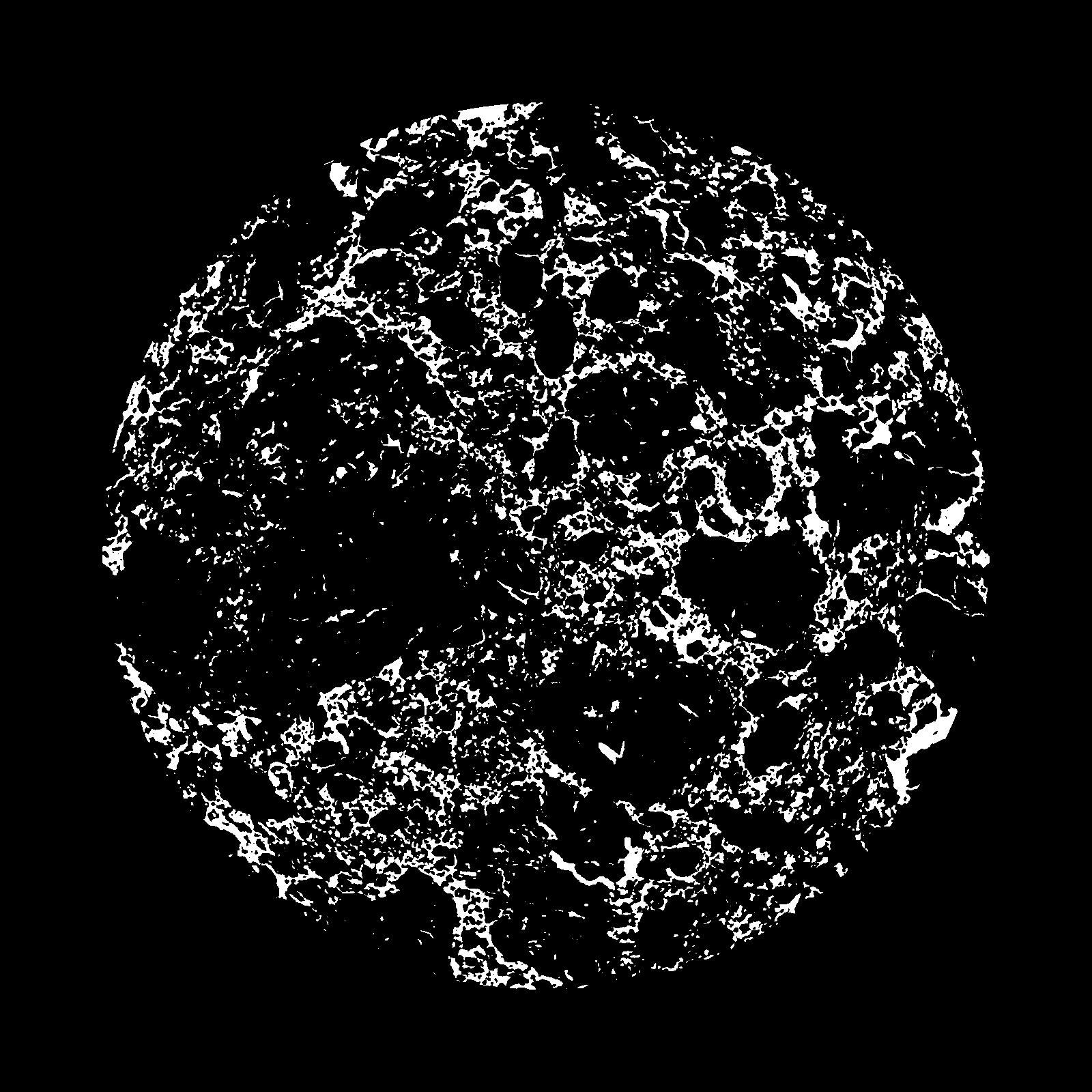
| XY Plane |
|
|---|
|
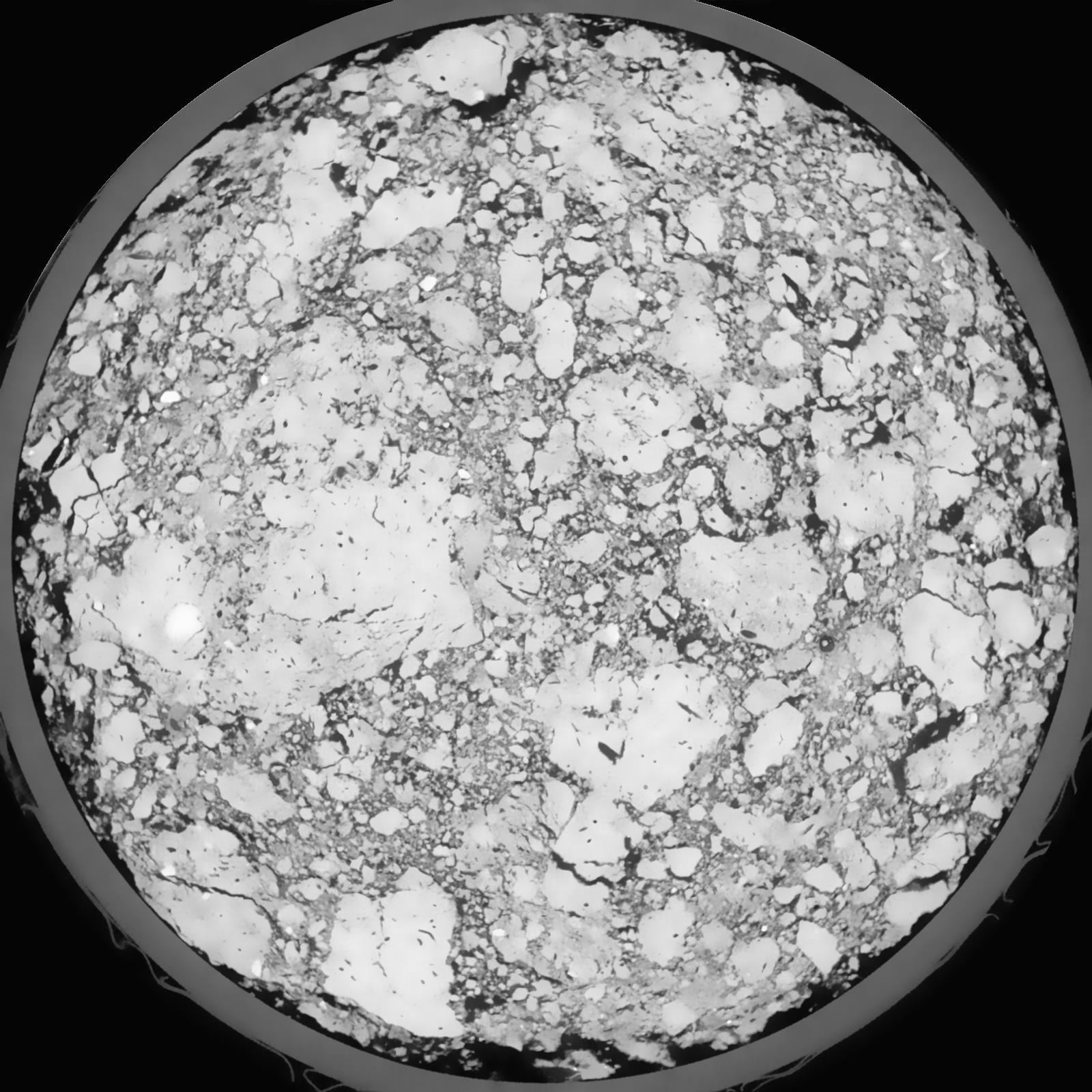
| XY Plane Grey |
|
|---|
|
| Texture | silt loam |
|---|
| Sand | 8.0 |
|---|
| Silt | 79.0 |
|---|
| Clay | 13.0 |
|---|
|
|
Results
| Porosity | Surface | Mean Curvature | Euler | MeanPoreSize | Gamma | PoreDist |
| 0.1602 | 1.5355 | 0.453888889 | -0.742592593 | 0.0 | 0.9224 | 0.337670127 |
| Opening size | Volume | Surface | MeanCurvature | Euler number |
|---|
| 0.12 | 0.1602 | 1.5355 | 0.453888889 | -0.742592593 |
| 0.15 | 0.1547 | 1.355833333 | 0.333333333 | -0.623611111 |
| 0.18 | 0.1481 | 1.246666667 | 0.289444444 | -0.569907407 |
| 0.21 | 0.1414 | 1.154 | 0.265027778 | -0.394305556 |
| 0.24 | 0.1374 | 1.101333333 | 0.269111111 | -0.174722222 |
| 0.27 | 0.1134 | 0.844 | 0.214027778 | -0.088194444 |
| 0.3 | 0.1012 | 0.727166667 | 0.191944444 | -0.012333796 |
| 0.36 | 0.0866 | 0.5875 | 0.163055556 | 0.066111111 |
| 0.42 | 0.05936 | 0.354333333 | 0.096638889 | 0.062453704 |
| 0.48 | 0.04633 | 0.2535 | 0.067 | 0.046108796 |
| 0.54 | 0.03196 | 0.150216667 | 0.035388889 | 0.025442593 |
| 0.6000000000000001 | 0.02679 | 0.116733333 | 0.026155556 | 0.018081944 |
| 0.6599999999999999 | 0.01938 | 0.072366667 | 0.014055556 | 0.009250463 |
| 0.72 | 0.0166 | 0.056566667 | 0.010066667 | 0.005952778 |
| 0.78 | 0.01346 | 0.041133333 | 0.006594444 | 0.003707269 |
| 0.8400000000000001 | 0.01224 | 0.035216667 | 0.005338889 | 0.002798241 |
| 0.8999999999999999 | 0.01023 | 0.026533333 | 0.003591667 | 0.001755602 |
| 1.2 | 0.006073 | 0.011458333 | 0.001071 | 0.00036538 |
| 1.5 | 0.004261 | 0.006553333 | 0.000474806 | 0.000142588 |
| 1.8 | 0.003181 | 0.004243333 | 0.000263072 | 0.000053472 |
| 2.1 | 0.00247 | 0.002981667 | 0.000170033 | 0.000044558 |
| 2.7 | 0.00158 | 0.00169 | 0.000088225 | 0.000017823 |
| 3.3000000000000003 | 0.0009909 | 0.000959167 | 0.000042242 | 0.000004745 |
| 3.9 | 0.0005785 | 0.000590667 | 0.000030478 | 0.000004745 |
| 4.5 | 0.0002901 | 0.0002945 | 0.000015506 | 0.000002372 |
Reference: An open Soil Structure Library based on X-ray CT data
 Soil Structure Library