General Information
Internal Identifier CG_P4_O_b
| Soil Type | Chernozem |
|---|
| Classification | WRB |
|---|
|
| Location | Bernburg (Westerfeld) |
|---|
| Latitude | 51.820 |
|---|
| Longitude | 11.700 |
|---|
|
| Landuse | agricultural crop rotation |
|---|
| Tillage | conventional tillage |
|---|
| Crop | winter wheat, maize, winter wheat, winter rape, winter barley |
|---|
|
| Sampling Depth | 13.0 |
|---|
| Sample Height | 10.0 |
|---|
| Sampling Date | March 28, 2017 |
|---|
| Voxel size | 0.06 |
|---|
| Pores white? | True |
|---|
|
| XY Plane |
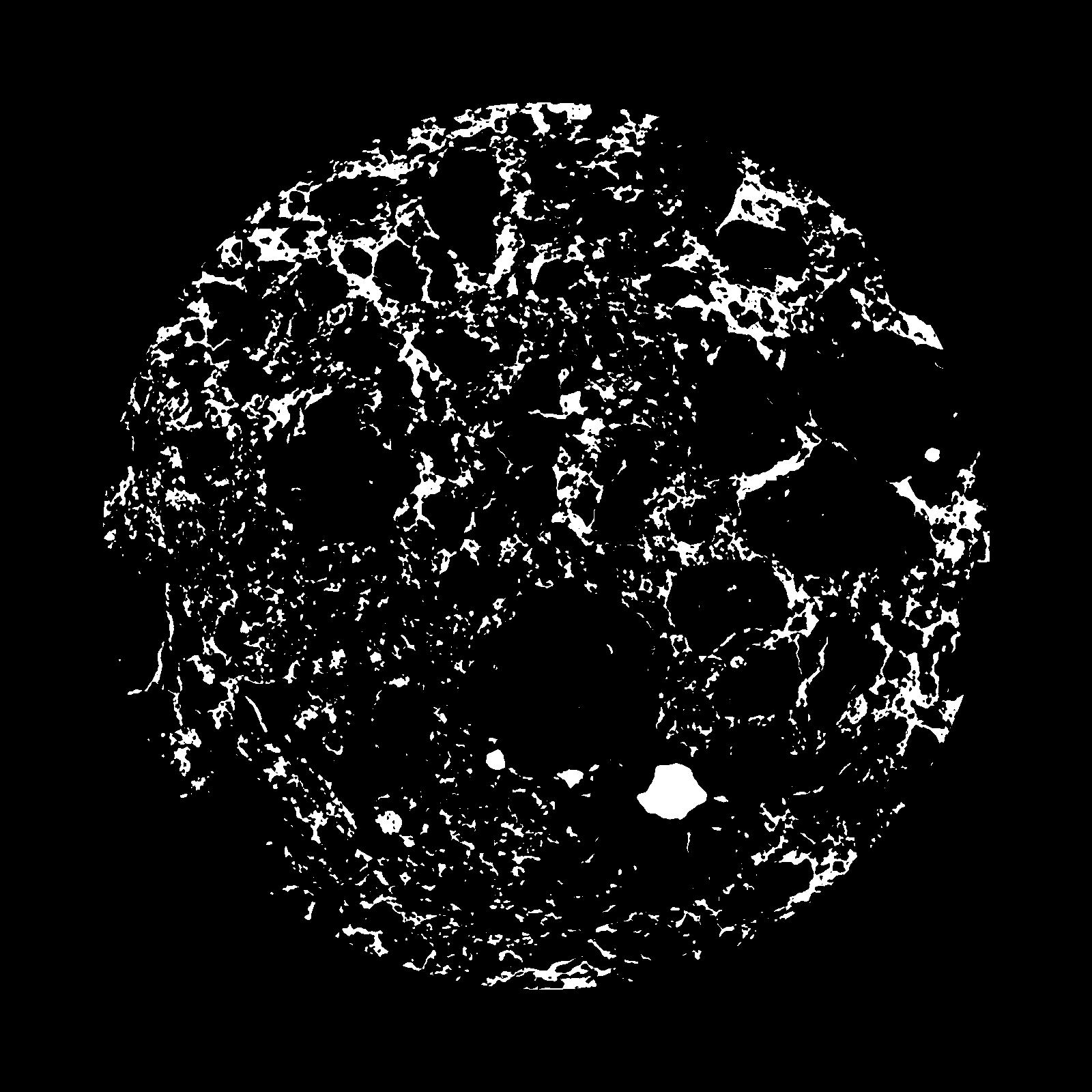
|
|---|
|
| XY Plane Grey |
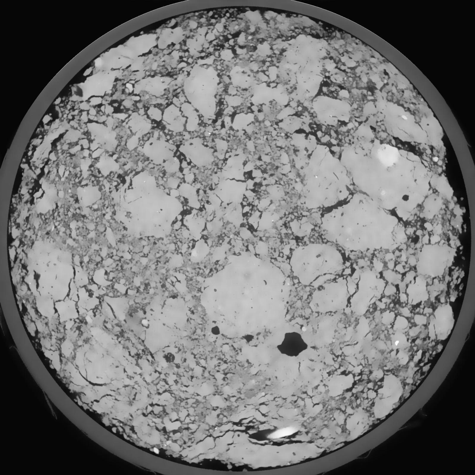
|
|---|
|
| Texture | silt loam |
|---|
| Sand | 8.0 |
|---|
| Silt | 79.0 |
|---|
| Clay | 13.0 |
|---|
|
|
Results
| Porosity | Surface | Mean Curvature | Euler | MeanPoreSize | Gamma | PoreDist |
| 0.1611 | 1.284666667 | 0.336111111 | -0.378148148 | 0.0 | 0.935 | 0.450432463 |
| Opening size | Volume | Surface | MeanCurvature | Euler number |
|---|
| 0.12 | 0.1611 | 1.284666667 | 0.336111111 | -0.378148148 |
| 0.15 | 0.1574 | 1.167833333 | 0.256861111 | -0.368287037 |
| 0.18 | 0.1534 | 1.1 | 0.226027778 | -0.363935185 |
| 0.21 | 0.1492 | 1.041666667 | 0.208666667 | -0.272083333 |
| 0.24 | 0.1466 | 1.007166667 | 0.210027778 | -0.14212963 |
| 0.27 | 0.1302 | 0.835 | 0.174583333 | -0.100046296 |
| 0.3 | 0.1213 | 0.7525 | 0.161055556 | -0.045003704 |
| 0.36 | 0.1092 | 0.6395 | 0.142055556 | 0.023990278 |
| 0.42 | 0.08526 | 0.448833333 | 0.099027778 | 0.038961574 |
| 0.48 | 0.0718 | 0.352333333 | 0.076805556 | 0.035076389 |
| 0.54 | 0.05469 | 0.239833333 | 0.048972222 | 0.026503241 |
| 0.6000000000000001 | 0.04755 | 0.1965 | 0.038972222 | 0.020621759 |
| 0.6599999999999999 | 0.03629 | 0.133733333 | 0.024466667 | 0.01373287 |
| 0.72 | 0.03149 | 0.107633333 | 0.018591667 | 0.0095 |
| 0.78 | 0.02581 | 0.080483333 | 0.012897222 | 0.006532407 |
| 0.8400000000000001 | 0.02352 | 0.0697 | 0.010816667 | 0.00514213 |
| 0.8999999999999999 | 0.01953 | 0.0525 | 0.007402778 | 0.003395324 |
| 1.2 | 0.01144 | 0.022583333 | 0.00235 | 0.000873333 |
| 1.5 | 0.00773 | 0.011981667 | 0.0009555 | 0.000311907 |
| 1.8 | 0.00586 | 0.007575 | 0.000464667 | 0.000133676 |
| 2.1 | 0.004902 | 0.005778333 | 0.000302111 | 0.000080204 |
| 2.7 | 0.003377 | 0.003585 | 0.000174311 | 0.000035647 |
| 3.3000000000000003 | 0.0026 | 0.002573333 | 0.000110147 | 0.000008315 |
| 3.9 | 0.001946 | 0.002028333 | 0.000098919 | 0.000008912 |
| 4.5 | 0.0001846 | 0.000212833 | 0.000012833 | 0.000002376 |
Reference: An open Soil Structure Library based on X-ray CT data
 Soil Structure Library