General Information
Internal Identifier CG_P4_U_a
| Soil Type | Chernozem |
|---|
| Classification | WRB |
|---|
|
| Location | Bernburg (Westerfeld) |
|---|
| Latitude | 51.820 |
|---|
| Longitude | 11.700 |
|---|
|
| Landuse | agricultural crop rotation |
|---|
| Tillage | conventional tillage |
|---|
| Crop | winter wheat, maize, winter wheat, winter rape, winter barley |
|---|
|
| Sampling Depth | 28.0 |
|---|
| Sample Height | 10.0 |
|---|
| Sampling Date | March 28, 2017 |
|---|
| Voxel size | 0.06 |
|---|
| Pores white? | True |
|---|
|
| XY Plane |
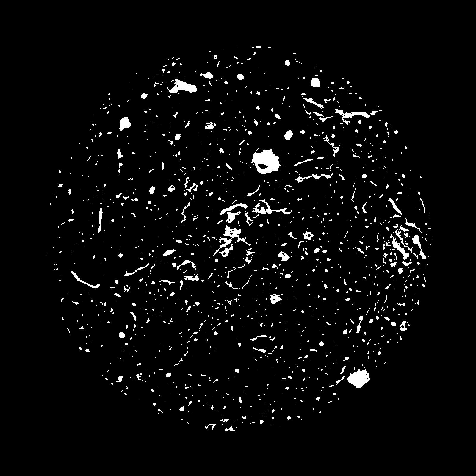
|
|---|
|
| XY Plane Grey |
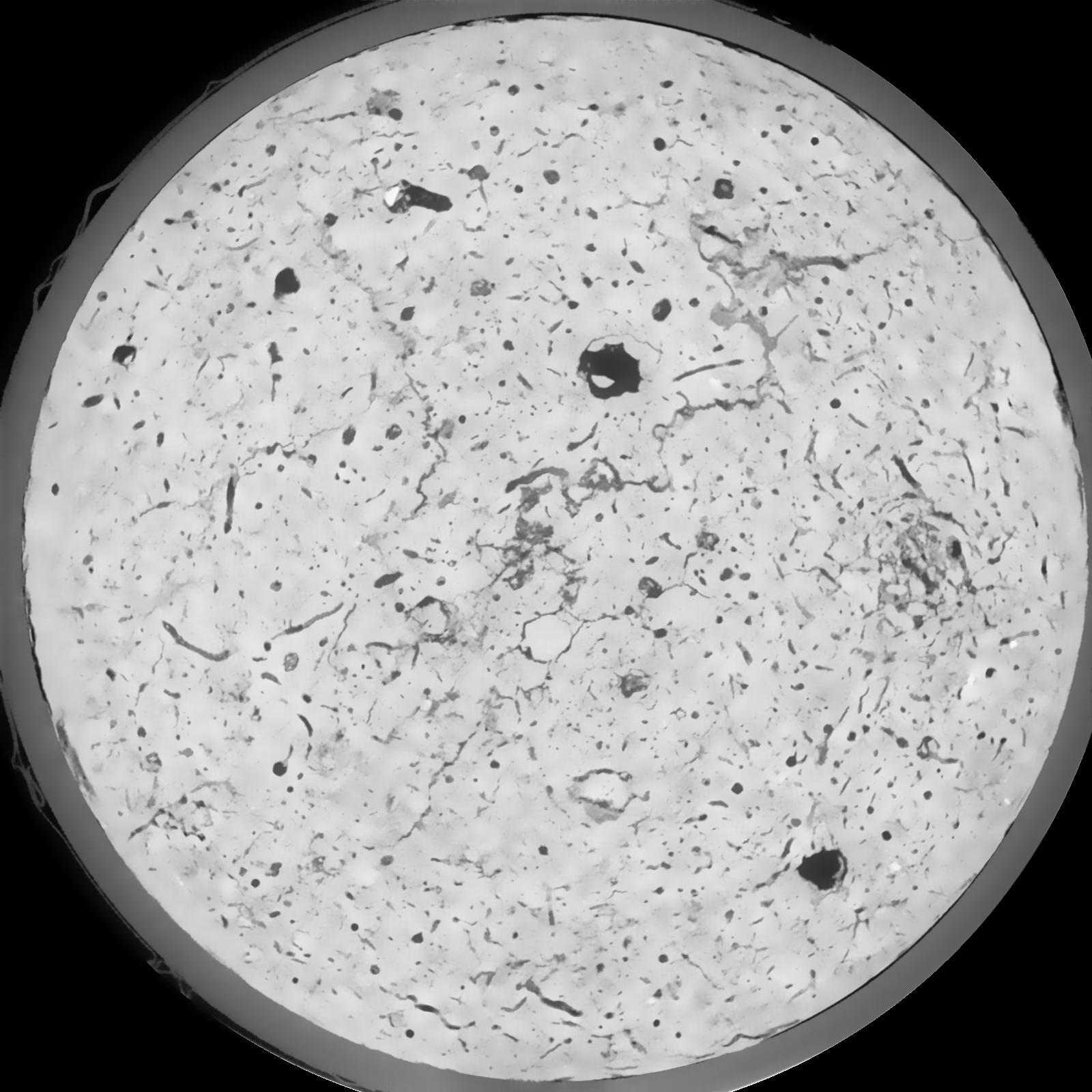
|
|---|
|
| Texture | silt loam |
|---|
| Sand | 8.0 |
|---|
| Silt | 79.0 |
|---|
| Clay | 13.0 |
|---|
|
|
Results
| Porosity | Surface | Mean Curvature | Euler | MeanPoreSize | Gamma | PoreDist |
| 0.0824 | 0.657833333 | 0.343333333 | 0.556018519 | 0.0 | 0.707 | 0.359553667 |
| Opening size | Volume | Surface | MeanCurvature | Euler number |
|---|
| 0.12 | 0.0824 | 0.657833333 | 0.343333333 | 0.556018519 |
| 0.15 | 0.07966 | 0.583333333 | 0.258055556 | 0.230138889 |
| 0.18 | 0.0775 | 0.537333333 | 0.213805556 | 0.143240741 |
| 0.21 | 0.07545 | 0.501166667 | 0.186972222 | 0.123333333 |
| 0.24 | 0.07446 | 0.486166667 | 0.181666667 | 0.152916667 |
| 0.27 | 0.06778 | 0.394 | 0.125611111 | 0.081805556 |
| 0.3 | 0.06472 | 0.358333333 | 0.108944444 | 0.074537037 |
| 0.36 | 0.06018 | 0.3085 | 0.088444444 | 0.062175926 |
| 0.42 | 0.05206 | 0.232333333 | 0.057944444 | 0.036512963 |
| 0.48 | 0.0472 | 0.193 | 0.04475 | 0.026175926 |
| 0.54 | 0.04045 | 0.1448 | 0.029527778 | 0.016578241 |
| 0.6000000000000001 | 0.03719 | 0.123716667 | 0.023891667 | 0.011957407 |
| 0.6599999999999999 | 0.03182 | 0.093166667 | 0.016388889 | 0.009758333 |
| 0.72 | 0.02901 | 0.0775 | 0.012805556 | 0.006285648 |
| 0.78 | 0.02555 | 0.0603 | 0.008961111 | 0.004522917 |
| 0.8400000000000001 | 0.02397 | 0.052366667 | 0.007269444 | 0.003187407 |
| 0.8999999999999999 | 0.02138 | 0.0408 | 0.004911111 | 0.002110093 |
| 1.2 | 0.01655 | 0.022416667 | 0.00169075 | 0.000587639 |
| 1.5 | 0.01397 | 0.01508 | 0.000734528 | 0.000222583 |
| 1.8 | 0.01267 | 0.012441667 | 0.000520306 | 0.000089032 |
| 2.1 | 0.0118 | 0.011003333 | 0.000424167 | 0.000053421 |
| 2.7 | 0.01036 | 0.009331667 | 0.000372333 | 0.000035613 |
| 3.3000000000000003 | 0.00868 | 0.007411667 | 0.000287944 | 0.000017807 |
| 3.9 | 0.007133 | 0.006003333 | 0.000241994 | 0.000017807 |
| 4.5 | 0.00414 | 0.003028333 | 0.000110581 | 0.000008903 |
| 5.1 | 0.00314 | 0.002105 | 0.000067844 | 0.000005607 |
| 5.699999999999999 | 0.002406 | 0.001625167 | 0.000055558 | 0.000005607 |
| 6.3 | 0.002171 | 0.0014975 | 0.000053419 | 0.000005607 |
| 6.8999999999999995 | 0.001832 | 0.001318833 | 0.000049147 | 0.000005607 |
Reference: An open Soil Structure Library based on X-ray CT data
 Soil Structure Library