General Information
Internal Identifier CG_P2_U_a
| Soil Type | Chernozem |
|---|
| Classification | WRB |
|---|
|
| Location | Bernburg (Westerfeld) |
|---|
| Latitude | 51.820 |
|---|
| Longitude | 11.700 |
|---|
|
| Landuse | agricultural crop rotation |
|---|
| Tillage | conventional tillage |
|---|
| Crop | winter wheat, maize, winter wheat, winter rape, winter barley |
|---|
|
| Sampling Depth | 28.0 |
|---|
| Sample Height | 10.0 |
|---|
| Sampling Date | March 28, 2017 |
|---|
| Voxel size | 0.06 |
|---|
| Pores white? | True |
|---|
|
| XY Plane |
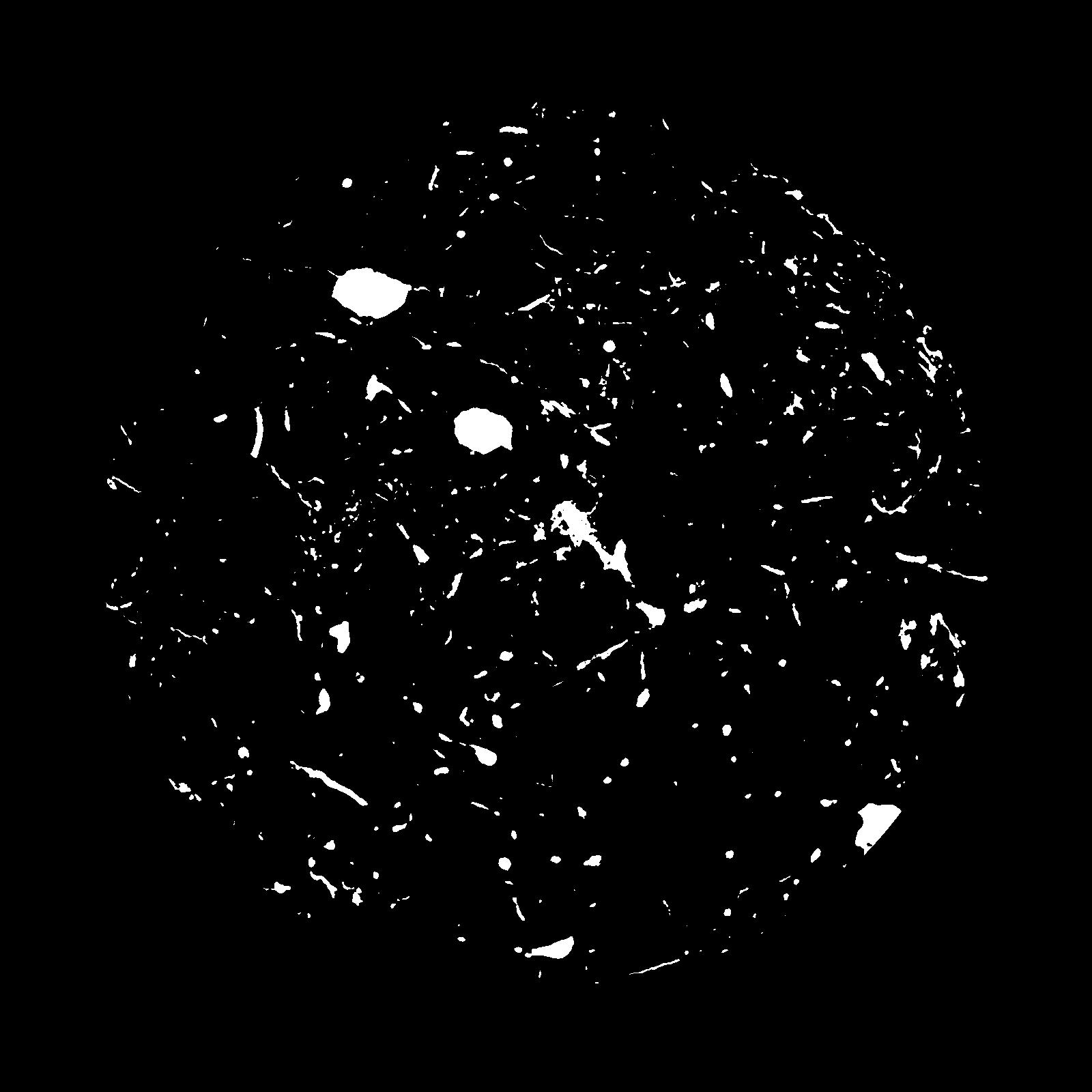
|
|---|
|
| XY Plane Grey |
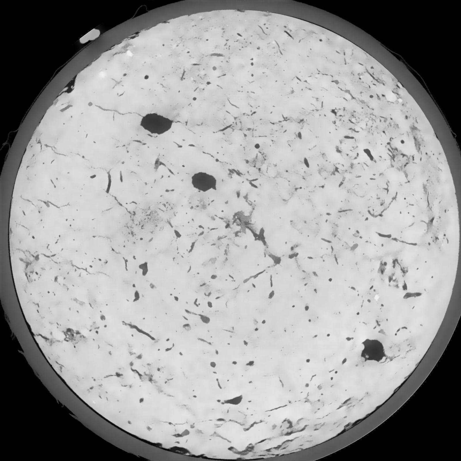
|
|---|
|
| Texture | silt loam |
|---|
| Sand | 8.0 |
|---|
| Silt | 79.0 |
|---|
| Clay | 13.0 |
|---|
|
|
Results
| Porosity | Surface | Mean Curvature | Euler | MeanPoreSize | Gamma | PoreDist |
| 0.04887 | 0.365 | 0.169527778 | 0.227083333 | 0.0 | 0.7778 | 0.59747671 |
| Opening size | Volume | Surface | MeanCurvature | Euler number |
|---|
| 0.12 | 0.04887 | 0.365 | 0.169527778 | 0.227083333 |
| 0.15 | 0.04738 | 0.324833333 | 0.127805556 | 0.086574074 |
| 0.18 | 0.04622 | 0.301333333 | 0.107527778 | 0.052592593 |
| 0.21 | 0.04519 | 0.283833333 | 0.095583333 | 0.046759259 |
| 0.24 | 0.04467 | 0.276166667 | 0.09325 | 0.062361111 |
| 0.27 | 0.041 | 0.227333333 | 0.066194444 | 0.036013889 |
| 0.3 | 0.03942 | 0.209666667 | 0.058444444 | 0.032906019 |
| 0.36 | 0.03701 | 0.184 | 0.048611111 | 0.028969444 |
| 0.42 | 0.03229 | 0.141366667 | 0.032861111 | 0.017891204 |
| 0.48 | 0.02941 | 0.11905 | 0.026102778 | 0.01401713 |
| 0.54 | 0.02503 | 0.088833333 | 0.017341667 | 0.010196759 |
| 0.6000000000000001 | 0.02292 | 0.075466667 | 0.013905556 | 0.007097685 |
| 0.6599999999999999 | 0.01943 | 0.055933333 | 0.0092 | 0.005672685 |
| 0.72 | 0.01778 | 0.04695 | 0.007225 | 0.00365125 |
| 0.78 | 0.01581 | 0.0374 | 0.005163889 | 0.002733981 |
| 0.8400000000000001 | 0.01492 | 0.033116667 | 0.004319444 | 0.001887963 |
| 0.8999999999999999 | 0.01342 | 0.0268 | 0.003138889 | 0.001469398 |
| 1.2 | 0.01008 | 0.014476667 | 0.001074528 | 0.00041856 |
| 1.5 | 0.008458 | 0.010076667 | 0.000514556 | 0.000142486 |
| 1.8 | 0.007446 | 0.00805 | 0.000325944 | 0.000044527 |
| 2.1 | 0.006756 | 0.007126667 | 0.000298694 | 0.000044527 |
| 2.7 | 0.005545 | 0.00562 | 0.0002506 | 0.000053435 |
| 3.3000000000000003 | 0.004224 | 0.004101667 | 0.000179536 | 0.000017811 |
| 3.9 | 0.003053 | 0.002865 | 0.000127169 | 0.000017811 |
| 4.5 | 0.002267 | 0.002225 | 0.000105264 | 0.000017811 |
| 5.1 | 0.0002189 | 0.000235833 | 0.000013358 | 0.000002392 |
Reference: An open Soil Structure Library based on X-ray CT data
 Soil Structure Library