General Information
Internal Identifier CG_P4_U_b
| Soil Type | Chernozem |
|---|
| Classification | WRB |
|---|
|
| Location | Bernburg (Westerfeld) |
|---|
| Latitude | 51.820 |
|---|
| Longitude | 11.700 |
|---|
|
| Landuse | agricultural crop rotation |
|---|
| Tillage | conventional tillage |
|---|
| Crop | winter wheat, maize, winter wheat, winter rape, winter barley |
|---|
|
| Sampling Depth | 28.0 |
|---|
| Sample Height | 10.0 |
|---|
| Sampling Date | March 28, 2017 |
|---|
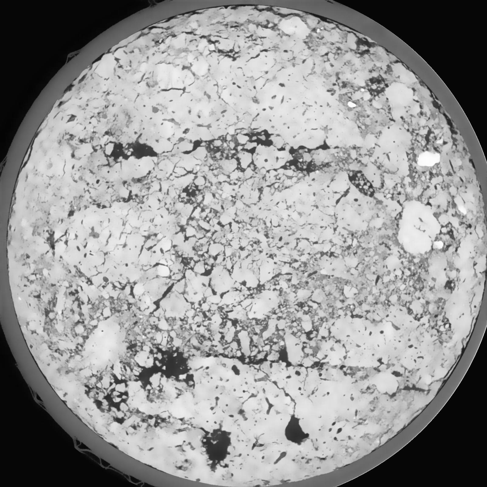
| Voxel size | 0.06 |
|---|
| Pores white? | True |
|---|
|
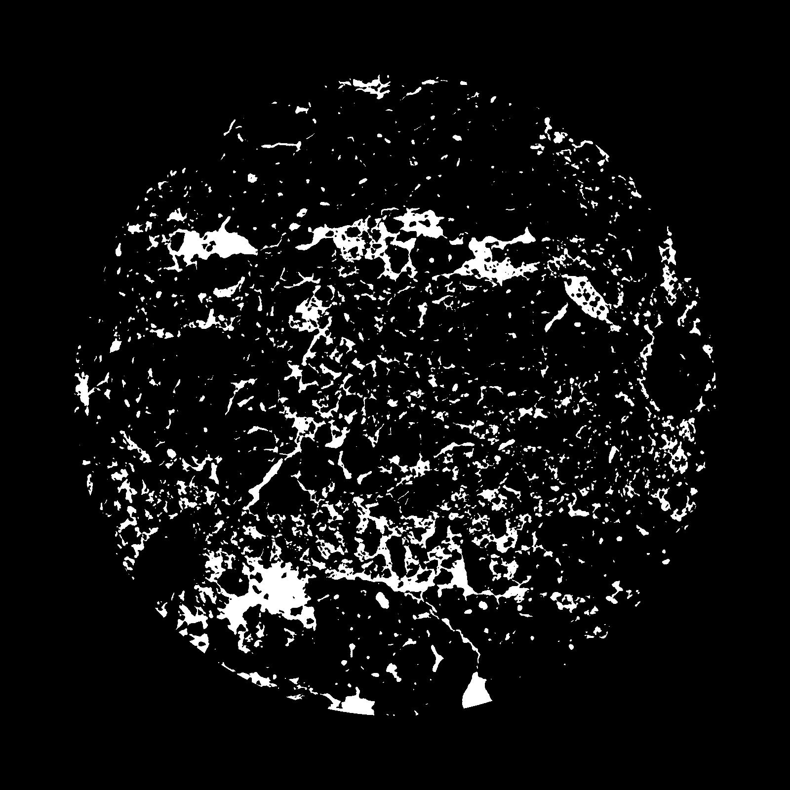
| XY Plane |
|
|---|
|
| XY Plane Grey |
|
|---|
|
| Texture | silt loam |
|---|
| Sand | 8.0 |
|---|
| Silt | 79.0 |
|---|
| Clay | 13.0 |
|---|
|
|
Results
| Porosity | Surface | Mean Curvature | Euler | MeanPoreSize | Gamma | PoreDist |
| 0.07311 | 0.650166667 | 0.3325 | 0.531018519 | 0.0 | 0.6898 | 0.375245426 |
| Opening size | Volume | Surface | MeanCurvature | Euler number |
|---|
| 0.12 | 0.07311 | 0.650166667 | 0.3325 | 0.531018519 |
| 0.15 | 0.07033 | 0.574166667 | 0.247472222 | 0.222222222 |
| 0.18 | 0.06814 | 0.5285 | 0.204944444 | 0.141111111 |
| 0.21 | 0.0661 | 0.493 | 0.179611111 | 0.123935185 |
| 0.24 | 0.06509 | 0.477833333 | 0.174527778 | 0.15412037 |
| 0.27 | 0.05846 | 0.387333333 | 0.12025 | 0.08087963 |
| 0.3 | 0.05546 | 0.353 | 0.104555556 | 0.072083333 |
| 0.36 | 0.05102 | 0.304833333 | 0.085277778 | 0.058564815 |
| 0.42 | 0.04301 | 0.232166667 | 0.057555556 | 0.033527315 |
| 0.48 | 0.03811 | 0.194 | 0.045805556 | 0.024482407 |
| 0.54 | 0.03103 | 0.145616667 | 0.031916667 | 0.017556019 |
| 0.6000000000000001 | 0.02748 | 0.123116667 | 0.026205556 | 0.013407407 |
| 0.6599999999999999 | 0.02169 | 0.09035 | 0.018269444 | 0.011065741 |
| 0.72 | 0.0187 | 0.0738 | 0.014516667 | 0.007602778 |
| 0.78 | 0.01486 | 0.054283333 | 0.010036111 | 0.0055375 |
| 0.8400000000000001 | 0.0132 | 0.045883333 | 0.008227778 | 0.004041806 |
| 0.8999999999999999 | 0.01047 | 0.033366667 | 0.005516667 | 0.002688611 |
| 1.2 | 0.005167 | 0.011931667 | 0.001483889 | 0.000623194 |
| 1.5 | 0.003449 | 0.006585 | 0.000670361 | 0.00024037 |
| 1.8 | 0.00213 | 0.003226667 | 0.000267614 | 0.000089028 |
| 2.1 | 0.001463 | 0.001691667 | 0.000098819 | 0.000035611 |
| 2.7 | 0.001019 | 0.000969167 | 0.000035256 | 0.000002956 |
| 3.3000000000000003 | 0.0008759 | 0.000887 | 0.000038994 | 0.000002956 |
| 3.9 | 0.0006175 | 0.000661333 | 0.000035789 | 0.000005911 |
| 4.5 | 0.0005051 | 0.000563833 | 0.000033117 | 0.000005911 |
Reference: An open Soil Structure Library based on X-ray CT data
 Soil Structure Library